|
search place name
|
||
Umarpur (Punjab, Pakistan)Umarpur is a town in the Punjab region of Pakistan. An overview map of the region around Umarpur is displayed below.
regional and 3d topo map of Umarpur, Pakistan ::

Umarpur airports ::
The nearest airport is LYP - Faisalabad Intl, located 134.9 km north of Umarpur.
Other airports nearby include MUX - Multan Intl (136.8 km west), LHE - Lahore Allama Iqbal Intl (212.9 km north east), ATQ - Amritsar (254.4 km north east), Nearby towns ::
Chak Two Hundred Eighty-five (1.9km south west) //
Chak Two Hundred Forty-three (2.8km north) //
Umaipur (2.9km south) //
Chak Two Hundred Fifty-one (2.8km north west) //
Chak Two Hundred Seventy-three (2.9km east) //
Chak Two Hundred Forty-one (3.0km east) //
Chak Two Hundred Eighty-seven (3.2km south west) //
Chak Two Hundred Eighty-three (3.4km south east) //
Chak Two Hundred Eighty-nine (3.7km south) //
Chak Two Hundred Sixty-seven (4.0km west) //
Chak Two Hundred Forty-five (4.8km north) //
Mukendpur (4.8km north west) //
Chak Two Hundred Forty-seven (5.0km north) //
Wān Dilāwar (4.9km south east) //
Chak Two Hundred Ninety-nine (5.1km south west) //
Chak Two Hundred Sixty-nine (5.2km west) //
Chak Twenty-nine (6.1km south) //
Chak Two Hundred Fifty-three (5.7km north west) //
Chak Two Hundred Twenty-nine (6.0km north east) //
Chāh Mirza Chavera (6.2km south) //
Rasūlpur (5.9km north east) //
Gaggo (6.8km north) //
Jang Bahādur (6.7km south east) //
Chak Two Hundred Thirty-nine (6.2km east) //
Ghaffārpur (7.1km north) //
Chak Three Hundred Five (6.8km south west) //
Chak Two Hundred Ninety-five (7.2km south) //
Khān Alam (6.5km east) //
Chak Two Hundred Seventy-seven (6.9km south east) //
[all distances 'as the bird flies' and approximate] 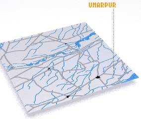 Places with similar names to Umarpur, Pakistan ::
Disclaimer :: Information on this page comes without warranty of any kind |
||
|
Where is Umarpur? Elevation and coordinates ::
Latitude (lat): 30°9'20"N Longitude (lon): 72°50'20"E
Elevation (approx.): 151m (map arrows pan, magnifying glasses zoom) |
||
|
Visiting Umarpur? Hotel/Accommodation ::
Book a hotel in Umarpur Travel Guide ::
Buy a travel guide for Pakistan rental cars ::
car rental offers GPS waypoint ::
download a GPX waypoint (PoI) of Umarpur for your GPS receiver
|
||