|
search place name
|
||
Umra Jūta (Punjab, Pakistan)Umra Jūta is a town in the Punjab region of Pakistan. An overview map of the region around Umra Jūta is displayed below.
regional and 3d topo map of Umra Jūta, Pakistan ::

Umra Jūta airports ::
The nearest airport is LYP - Faisalabad Intl, located 99.5 km north east of Umra Jūta.
Other airports nearby include MUX - Multan Intl (101.8 km south west), Nearby towns ::
Basti Murād (1.1km west) //
Kulāchi Fauja Dhāra (2.5km north) //
Mīrak Siāl (2.2km east) //
Allāhyār Jūta (2.7km north west) //
Sāhibwāla (2.6km south east) //
Basti Dhalāni (2.6km west) //
Yārewāla (2.9km south west) //
Basti Derewāli (3.4km south west) //
Chak Five Hundred Three (4.1km south east) //
Māriwāla (5.0km south) //
Binda Fauja Dhāra (5.1km north west) //
Basti Qāim (4.6km east) //
Jandwāla (4.6km east) //
Mangan (5.6km south west) //
Hassuwāli (5.2km south west) //
Tāhliwāla (6.3km south) //
Basti Niwāni (6.4km south) //
Kakkuwāla (6.5km north) //
Rakh Bhangu (6.8km south) //
Nawābpur (6.0km west) //
Chak Five Hundred Two (6.3km south east) //
Pīru (6.3km north west) //
Mirāsiwāla (6.7km south west) //
Basti Nānak (7.3km south) //
Farīd Mahmūd Kāthia (6.8km north east) //
Kaurewāla (6.7km east) //
Basti Islāmpur (8.0km north) //
Sādiq Nihang (7.3km east) //
Wānwāla (8.1km north west) //
[all distances 'as the bird flies' and approximate] 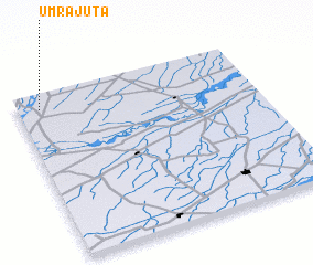 Places with similar names to Umra Jūta, Pakistan :: Disclaimer :: Information on this page comes without warranty of any kind |
||
|
Where is Umra Jūta? Elevation and coordinates ::
Latitude (lat): 30°54'40"N Longitude (lon): 72°5'40"E
Elevation (approx.): 148m (map arrows pan, magnifying glasses zoom) |
||
|
Visiting Umra Jūta? Hotel/Accommodation ::
Book a hotel in Umra Jūta Travel Guide ::
Buy a travel guide for Pakistan rental cars ::
car rental offers GPS waypoint ::
download a GPX waypoint (PoI) of Umra Jūta for your GPS receiver
|
||