|
search place name
|
||
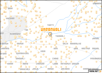
Umranwāli (Punjab, Pakistan)Umranwāli is a town in the Punjab region of Pakistan. An overview map of the region around Umranwāli is displayed below.
regional and 3d topo map of Umranwāli, Pakistan ::
Umranwāli airports ::
The nearest airport is IXJ - Jammu, located 25.5 km north east of Umranwāli.
Other airports nearby include ATQ - Amritsar (88.3 km south), IXP - Pathankot (94.3 km east), LHE - Lahore Allama Iqbal Intl (111.7 km south), SXR - Srinagar (165.2 km north), Nearby towns ::
Joiān (0.0km north) //
Nekowāl (0.3km south east) //
Bhmowal (0.5km west) //
Jinda (0.9km south) //
Khokhar (1.3km west) //
Taungarh (1.6km west) //
Niki Thatti (2.2km north) //
Sonde (2.4km south west) //
Anula (2.4km south east) //
Bājragarhi (2.4km south east) //
Dajowāl (2.7km south) //
Salīm (2.7km south east) //
Tāu (2.8km north west) //
Thatti (3.1km north) //
Chak Nānke (3.0km south east) //
Mahmūnwāli (3.3km south) //
Karlūg (3.0km west) //
Tugowāli (3.1km east) //
Shāhrak (3.7km south) //
Sarobe (3.7km south) //
Bularwāli (3.7km south) //
Garhi (3.1km west) //
Karān Dīn (3.3km south west) //
Wagrān (3.2km west) //
Sadre (3.3km west) //
Thakkar Haspāl (3.8km south west) //
Makābar (4.0km south west) //
Bilola (4.0km south west) //
Khokhar (3.6km south west) //
[all distances 'as the bird flies' and approximate]  Places with similar names to Umranwāli, Pakistan ::
// Umrnwāla (PK)
Disclaimer :: Information on this page comes without warranty of any kind |
||
|
Where is Umranwāli? Elevation and coordinates ::
Latitude (lat): 32°30'0"N Longitude (lon): 74°41'0"E
Elevation (approx.): 259m (map arrows pan, magnifying glasses zoom) |
||
|
Visiting Umranwāli? Hotel/Accommodation ::
Book a hotel in Umranwāli Travel Guide ::
Buy a travel guide for Pakistan rental cars ::
car rental offers GPS waypoint ::
download a GPX waypoint (PoI) of Umranwāli for your GPS receiver
|
||