|
search place name
|
||
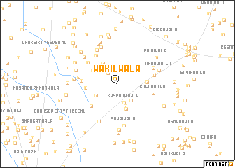
Wakīlwāla (Punjab, Pakistan)Wakīlwāla is a town in the Punjab region of Pakistan. An overview map of the region around Wakīlwāla is displayed below.
regional and 3d topo map of Wakīlwāla, Pakistan ::
Wakīlwāla airports ::
The nearest airport is MUX - Multan Intl, located 126.3 km south of Wakīlwāla.
Other airports nearby include LYP - Faisalabad Intl (158.4 km east), PZH - Zhob (177.7 km west), Nearby towns ::
Sajhan Rāmwāla (2.2km north west) //
Kasrānawāla (3.1km south) //
Jārīwāla (3.2km south east) //
Bhāndewāla (3.2km north west) //
Ahmad Khandoāwāla (3.7km south) //
Sāleh Muhammadwāla (3.4km south west) //
Lelanwāla (3.8km north west) //
Magasiwāla (4.2km south) //
Honāwāla (4.1km north west) //
Piārawāla (4.1km east) //
Siālānwāla (4.4km west) //
Muhammad Amīnwāla (5.0km south west) //
Gundewāla (5.3km north west) //
Bhattiānwāla (4.9km west) //
Mahtāb Shāhwāla (5.3km north west) //
Kalrāwāla (5.1km east) //
Piorāpittanwāla (5.1km east) //
Kahnewāla (5.2km east) //
Fatehwāla (5.5km north east) //
Dera Mistriān (5.4km west) //
Shadāwāla (6.1km north west) //
Ganjāwāla (6.3km north) //
Lāl Khānwāla (6.5km south west) //
Sawāiwāla (6.7km south) //
Madanāwāla (6.2km north west) //
Ahmadwāla (6.1km east) //
Lohechānwāla (6.1km west) //
Samrāunwāla (6.0km west) //
Gulwāla (6.9km north west) //
[all distances 'as the bird flies' and approximate] 
Disclaimer :: Information on this page comes without warranty of any kind |
||
|
Where is Wakīlwāla? Elevation and coordinates ::
Latitude (lat): 31°20'25"N Longitude (lon): 71°19'50"E
Elevation (approx.): 158m (map arrows pan, magnifying glasses zoom) |
||
|
Visiting Wakīlwāla? Hotel/Accommodation ::
Book a hotel in Wakīlwāla Travel Guide ::
Buy a travel guide for Pakistan rental cars ::
car rental offers GPS waypoint ::
download a GPX waypoint (PoI) of Wakīlwāla for your GPS receiver
|
||