|
search place name
|
||
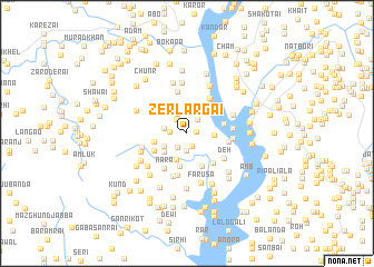
Zer Largai (Punjab, Pakistan)Zer Largai is a town in the Punjab region of Pakistan. An overview map of the region around Zer Largai is displayed below.
regional and 3d topo map of Zer Largai, Pakistan ::
Zer Largai airports ::
The nearest airport is SDT - Saidu Sharif, located 65.2 km north west of Zer Largai.
Other airports nearby include MFG - Muzaffarabad (65.6 km east), ISB - Islamabad Chaklala (86.5 km south), RAZ - Rawala Kot Rawalakot (108.1 km south east), PEW - Peshawar Intl (124.7 km west), Nearby towns ::
Bādar (0.8km east) //
Shirgāh (1.3km south) //
Biland Garhi (1.6km south west) //
Doga (1.7km south) //
Gwāndla (1.7km north west) //
Chamgāh (1.7km north east) //
Chānjlo Bānda (1.5km west) //
Kot (2.1km north) //
Chaklai (2.0km west) //
Karamdīn (2.3km south west) //
Sathāna (2.3km east) //
Shergāh (2.8km south) //
Pat Bāndai (2.9km north) //
Parba (2.7km south west) //
Degra (3.3km south) //
Rahīm (2.8km west) //
Tarbori (3.5km south) //
Koprai (3.2km south west) //
Tirbat (3.2km east) //
Baitgali (3.7km south east) //
Kai (4.0km north east) //
Nāra (4.0km south west) //
Chhāoni (3.5km east) //
Shingrai (4.2km south) //
Kuz Dūlai (4.2km north) //
Bar Dūlai (4.2km north) //
Deh (3.9km south east) //
Shilidār (4.5km south) //
Maira (3.9km east) //
[all distances 'as the bird flies' and approximate]  Places with similar names to Zer Largai, Pakistan ::
// Cerro Largo (PA)
// Cerro Largo (PA)
// Cerro Largo (MX)
// Cerro Largo (VE)
// Cerro Largo (VE)
// Cêrro Largo (BR)
Disclaimer :: Information on this page comes without warranty of any kind |
||
|
Where is Zer Largai? Elevation and coordinates ::
Latitude (lat): 34°21'15"N Longitude (lon): 72°47'45"E
Elevation (approx.): 1224m (map arrows pan, magnifying glasses zoom) |
||
|
Visiting Zer Largai? Hotel/Accommodation ::
Book a hotel in Zer Largai Travel Guide ::
Buy a travel guide for Pakistan rental cars ::
car rental offers GPS waypoint ::
download a GPX waypoint (PoI) of Zer Largai for your GPS receiver
|
||