|
search place name
|
||
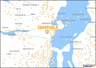
Zoharwāla (Punjab, Pakistan)Zoharwāla is a town in the Punjab region of Pakistan. An overview map of the region around Zoharwāla is displayed below.
regional and 3d topo map of Zoharwāla, Pakistan ::
Zoharwāla airports ::
The nearest airport is MUX - Multan Intl, located 71.6 km east of Zoharwāla.
Other airports nearby include PZH - Zhob (158.7 km north west), SUL - Sui (247.1 km south west), Nearby towns ::
Bahādurwāla (0.8km north east) //
Dholwāla (1.1km east) //
Sabzāni (1.4km north) //
Jatwāla (1.4km south east) //
Basti Rānjha (1.5km east) //
Khajjiwāla (1.7km north) //
Zahrwāli (1.8km north east) //
Lāngewāla (1.9km south west) //
Doratta (1.9km south east) //
Sāhīwāla (1.9km east) //
Relwāla (2.1km north east) //
Makhdūmwāla (2.2km north east) //
Ludāni (2.4km north) //
Basti Jamāl (2.6km south) //
Basti Shaikh (2.8km south) //
Nautak (2.7km south east) //
Dūmnīwāla (2.8km north east) //
Zarīnwāla (2.7km north east) //
Sobhā Rind (3.1km north) //
Ghuman (3.2km north) //
Solewāla (3.3km south) //
Nūrpur (3.2km north east) //
Paulīwāla (3.5km south) //
Mochīwāla (3.6km north) //
Ruwālwāla (3.9km south) //
Massuwāla (4.0km south) //
Sādiqwāla (3.9km north east) //
Gosāīnwāla (4.2km south) //
Kāla (4.5km south) //
[all distances 'as the bird flies' and approximate]  Places with similar names to Zoharwāla, Pakistan :: Disclaimer :: Information on this page comes without warranty of any kind |
||
|
Where is Zoharwāla? Elevation and coordinates ::
Latitude (lat): 30°25'15"N Longitude (lon): 70°43'5"E
Elevation (approx.): 137m (map arrows pan, magnifying glasses zoom) |
||
|
Visiting Zoharwāla? Hotel/Accommodation ::
Book a hotel in Zoharwāla Travel Guide ::
Buy a travel guide for Pakistan rental cars ::
car rental offers GPS waypoint ::
download a GPX waypoint (PoI) of Zoharwāla for your GPS receiver
|
||