|
search place name
|
||
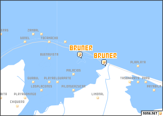
Bruner (Gracias a Dios, Honduras)Bruner is a town in the Gracias a Dios region of Honduras. An overview map of the region around Bruner is displayed below.
regional and 3d topo map of Bruner, Honduras ::
Bruner airports ::
The nearest airport is GJA - Guanaja, located 116.1 km north west of Bruner.
Other airports nearby include RTB - Roatan Juan Manuel Galvez Intl (173.1 km west), LCE - La Ceiba Goloson Intl (205.1 km west), PUZ - Puerto Cabezas (269.4 km south east), Nearby towns ::
Jaloba (1.9km north) //
La Criba (1.9km north) //
Palacios (4.1km south west) //
Cayo Palacio (5.1km north west) //
Pueblo Nuevo (5.1km north west) //
Bruner (5.7km east) //
Bacalar (7.1km west) //
Buena Vista (7.1km west) //
Pilón de Azúcar (7.6km south) //
Playa El Guapate (7.7km south west) //
Tocamacho (8.0km north west) //
Playa El Boom (9.0km south west) //
El Limonal (9.0km south west) //
[all distances 'as the bird flies' and approximate] 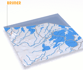 Places with similar names to Bruner, Honduras ::
Disclaimer :: Information on this page comes without warranty of any kind |
||
|
Where is Bruner? Elevation and coordinates ::
Latitude (lat): 15°57'0"N Longitude (lon): 84°57'0"W
Elevation (approx.): 5m (map arrows pan, magnifying glasses zoom) |
||
|
Visiting Bruner? Hotel/Accommodation ::
Book a hotel in Bruner Travel Guide ::
Buy a travel guide for Honduras rental cars ::
car rental offers GPS waypoint ::
download a GPX waypoint (PoI) of Bruner for your GPS receiver
|
||