|
search place name
|
||
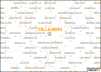
Callejones (Ocotepeque, Honduras)Callejones is a town in the Ocotepeque region of Honduras. An overview map of the region around Callejones is displayed below.
regional and 3d topo map of Callejones, Honduras ::
Callejones airports ::
The nearest airport is SAL - San Salvador El Salvador Intl, located 102.5 km south of Callejones.
Other airports nearby include GUA - Guatemala City La Aurora (164.6 km west), SAP - San Pedro Sula La Mesa Intl (168.1 km north east), CBV - Coban (193.0 km north west), TGU - Tegucigalpa Toncontin Intl (197.1 km east), Nearby towns ::
Aldea Nueva (1.8km west) //
Yuscarán (1.8km west) //
Santa Teresa (2.6km north east) //
El Chilacayote (2.6km south east) //
Jocotán (3.6km west) //
El Matasano (3.7km north) //
El Yoroconte (3.7km south) //
Las Vegas del Río Chiquito (3.7km south) //
El Cunce (3.6km east) //
El Rastrojón (4.1km north west) //
Valle de Jesús (4.1km south west) //
San José de Jocotán (5.4km west) //
El Sillón (5.4km west) //
Plan del Rosario (5.6km south) //
El Coral (5.6km south) //
Santa Rita (5.6km north) //
El Jaralón (5.7km west) //
Las Cuevas (5.7km east) //
Los Llanitos (6.6km south west) //
El Jocote (6.5km north east) //
La Granadita (6.5km north west) //
El Limoncito (6.5km south east) //
Mercedes (6.6km south east) //
El Coloal (6.6km north east) //
El Tablón (7.2km east) //
El Refugio (7.2km east) //
La Hacienda de Sinacar (7.6km north) //
El Sile (7.6km north) //
La Granadilla (7.4km west) //
[all distances 'as the bird flies' and approximate]  Places with similar names to Callejones, Honduras ::
// Galligianesi (IT)
// Kljenci (BA)
// Callejones (ES)
// Gallejones (ES)
// Callejones (CL)
// Callejones (MX)
// Callejones (MX)
// Callejones (MX)
// Callejones (HN)
// Callejones (PE)
Disclaimer :: Information on this page comes without warranty of any kind |
||
|
Where is Callejones? Elevation and coordinates ::
Latitude (lat): 14°22'0"N Longitude (lon): 89°1'0"W
Elevation (approx.): 1585m (map arrows pan, magnifying glasses zoom) |
||
|
Visiting Callejones? Hotel/Accommodation ::
Book a hotel in Callejones Travel Guide ::
Buy a travel guide for Honduras rental cars ::
car rental offers GPS waypoint ::
download a GPX waypoint (PoI) of Callejones for your GPS receiver
|
||