|
search place name
|
||
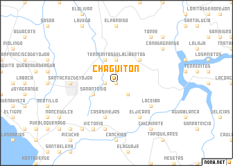
Chagüitón (Cortés, Honduras)Chagüitón is a town in the Cortés region of Honduras. An overview map of the region around Chagüitón is displayed below.
regional and 3d topo map of Chagüitón, Honduras ::
Chagüitón airports ::
The nearest airport is SAP - San Pedro Sula La Mesa Intl, located 52.8 km north of Chagüitón.
Other airports nearby include TEA - Tela (95.7 km north east), TGU - Tegucigalpa Toncontin Intl (121.8 km south east), LCE - La Ceiba Goloson Intl (134.7 km north east), RTB - Roatan Juan Manuel Galvez Intl (203.7 km north east), Nearby towns ::
La Laguna (0.0km north) //
Tocorrostique (1.8km west) //
La Sandillera (1.8km west) //
La Majada (1.9km north) //
Los Mangos (2.6km south east) //
Terreritos de La Libertad (3.7km north) //
San Antonio (4.0km south west) //
El Zapote (4.1km north west) //
Los Planes (5.2km north east) //
Casas Viejas (5.8km south) //
El Jícaro (6.6km south east) //
La Ceiba (6.5km south east) //
Santa Cruz de Yojoa (7.2km west) //
Los Planes (7.6km south) //
Victoria (8.2km south west) //
San Isidro (9.2km south west) //
Agua Amarilla (9.1km north east) //
Cañada Grande (9.1km north east) //
Chichipate (9.2km south east) //
El Pescado (9.2km north east) //
Torre (9.2km north east) //
Pozo de Zarco (10.3km south west) //
El Corocillo (10.3km south west) //
San Lorenzo (10.3km south west) //
Cordoncillos (10.3km south west) //
Talquezalar (10.3km south west) //
Cañizales (10.3km south west) //
Los Picachos (10.3km south west) //
Las Jaguas (10.3km south west) //
[all distances 'as the bird flies' and approximate]  Places with similar names to Chagüitón, Honduras ::
Disclaimer :: Information on this page comes without warranty of any kind |
||
|
Where is Chagüitón? Elevation and coordinates ::
Latitude (lat): 14°59'0"N Longitude (lon): 87°50'0"W
Elevation (approx.): 611m (map arrows pan, magnifying glasses zoom) |
||
|
Visiting Chagüitón? Hotel/Accommodation ::
Book a hotel in Chagüitón Travel Guide ::
Buy a travel guide for Honduras rental cars ::
car rental offers GPS waypoint ::
download a GPX waypoint (PoI) of Chagüitón for your GPS receiver
|
||