|
search place name
|
||
Coyocutena (Comayagua, Honduras)Coyocutena is a town in the Comayagua region of Honduras. An overview map of the region around Coyocutena is displayed below.
regional and 3d topo map of Coyocutena, Honduras ::

Coyocutena airports ::
The nearest airport is TGU - Tegucigalpa Toncontin Intl, located 73.7 km south east of Coyocutena.
Other airports nearby include SAP - San Pedro Sula La Mesa Intl (98.4 km north west), TEA - Tela (126.8 km north), LCE - La Ceiba Goloson Intl (144.7 km north east), SAL - San Salvador El Salvador Intl (208.0 km south west), Nearby towns ::
Laguna Seca (1.9km south) //
Plan de Leones (1.8km east) //
San Antonio de la Cuesta (3.6km west) //
San Jerónimo (3.6km west) //
Mal Paso (3.7km south) //
Sompopera (3.7km south) //
Jacintillo (4.1km south east) //
Pie de la Cuesta (5.2km south west) //
El Pedregal (5.2km south west) //
Ocotillal (5.6km south) //
El Portillo (5.8km south) //
El Cacao (5.8km south) //
Cuchilla La Loma Alta (5.8km south) //
La Crucita (5.8km south) //
Talanguita (6.5km south west) //
Maderos (6.5km north west) //
La Capulina (7.4km north) //
Ocotes Caídos (7.2km east) //
Sabana Larga (7.4km west) //
Las Arenas (7.4km east) //
Jamalteca (7.6km north) //
Los Alfaros (7.6km north) //
Los Tolnetes (7.6km north) //
San José (7.6km north) //
La Bernardina (7.7km north west) //
La Laguna (7.7km south east) //
Los Hobos (8.2km north west) //
Cacaguapa (9.1km south west) //
Ranchitos (9.2km north west) //
[all distances 'as the bird flies' and approximate] 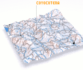 Places with similar names to Coyocutena, Honduras ::
Disclaimer :: Information on this page comes without warranty of any kind |
||
|
Where is Coyocutena? Elevation and coordinates ::
Latitude (lat): 14°38'0"N Longitude (lon): 87°34'0"W
Elevation (approx.): 703m (map arrows pan, magnifying glasses zoom) |
||
|
Visiting Coyocutena? Hotel/Accommodation ::
Book a hotel in Coyocutena Travel Guide ::
Buy a travel guide for Honduras rental cars ::
car rental offers GPS waypoint ::
download a GPX waypoint (PoI) of Coyocutena for your GPS receiver
|
||