|
search place name
|
||
El Aguacatillo (Lempira, Honduras)El Aguacatillo is a town in the Lempira region of Honduras. An overview map of the region around El Aguacatillo is displayed below.
regional and 3d topo map of El Aguacatillo, Honduras ::

El Aguacatillo airports ::
The nearest airport is SAL - San Salvador El Salvador Intl, located 111.0 km south of El Aguacatillo.
Other airports nearby include SAP - San Pedro Sula La Mesa Intl (149.6 km north east), TGU - Tegucigalpa Toncontin Intl (177.0 km east), GUA - Guatemala City La Aurora (185.3 km west), CBV - Coban (206.9 km north west), Nearby towns ::
La Moaga (2.6km north east) //
El Rión (2.6km north east) //
El Jutal (2.6km north east) //
El Ciprés (2.6km north east) //
Magueyal (3.7km north) //
Hierba Buena (3.6km east) //
Pacayonas (4.0km north west) //
Miantago (4.1km north east) //
Peña Blanca (4.1km north east) //
Tullal (4.0km north east) //
La Peñona (5.2km south west) //
Plan del Roblar (5.7km west) //
El Granzal (5.7km west) //
Paletal (5.8km north) //
Santa Marta (6.6km north west) //
Cruz Alta (7.4km north) //
San Juan (7.2km west) //
Cubite (7.2km east) //
El Cascajal (7.6km north) //
Los Planes (7.6km north) //
Belén Gualcho (7.6km north) //
Jualaca (7.4km east) //
Malcincales (7.6km south) //
Las Crucitas (7.7km north east) //
Palos Blancos (8.2km north west) //
El Naranjo (8.1km north west) //
El Pitillo (8.2km north east) //
Calbario (8.2km north east) //
El Paraíso (8.2km north east) //
[all distances 'as the bird flies' and approximate] 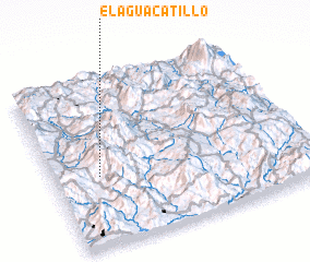 Places with similar names to El Aguacatillo, Honduras ::
// El Aguacatal (CO)
// El Aguacatal (MX)
// El Aguacatillo (MX)
// El Aguacatal (HN)
// El Aguacatal (HN)
// El Aguacatal (HN)
// El Aguacatal (HN)
// El Aguacatal (HN)
// El Aguacatillo (HN)
// El Aguacatillo (HN)
Disclaimer :: Information on this page comes without warranty of any kind |
||
|
Where is El Aguacatillo? Elevation and coordinates ::
Latitude (lat): 14°25'0"N Longitude (lon): 88°49'0"W
Elevation (approx.): 2161m (map arrows pan, magnifying glasses zoom) |
||
|
Visiting El Aguacatillo? Hotel/Accommodation ::
Book a hotel in El Aguacatillo Travel Guide ::
Buy a travel guide for Honduras rental cars ::
car rental offers GPS waypoint ::
download a GPX waypoint (PoI) of El Aguacatillo for your GPS receiver
|
||