|
search place name
|
||
El Cantón (El Paraíso, Honduras)El Cantón is a town in the El Paraíso region of Honduras. An overview map of the region around El Cantón is displayed below.
regional and 3d topo map of El Cantón, Honduras ::

El Cantón airports ::
The nearest airport is TGU - Tegucigalpa Toncontin Intl, located 98.6 km west of El Cantón.
Other airports nearby include MGA - Managua Intl (197.0 km south), LCE - La Ceiba Goloson Intl (210.1 km north), TEA - Tela (240.6 km north west), SAP - San Pedro Sula La Mesa Intl (242.6 km north west), Nearby towns ::
Escuapa (5.2km north west) //
Malacate (6.5km south east) //
San Francisco (9.2km north west) //
[all distances 'as the bird flies' and approximate] 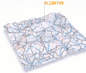 Places with similar names to El Cantón, Honduras ::
// El Quintín (PA)
// El Cañadón (CU)
// El Cantón (ES)
// El Cantón (MX)
// El Cantón (MX)
// El Cantón (MX)
// El Cantón (HN)
// El Cantón (HN)
// El Cañadón (VE)
// El Cañadón (VE)
Disclaimer :: Information on this page comes without warranty of any kind |
||
|
Where is El Cantón? Elevation and coordinates ::
Latitude (lat): 13°55'0"N Longitude (lon): 86°19'0"W
Elevation (approx.): 619m (map arrows pan, magnifying glasses zoom) |
||
|
Visiting El Cantón? Hotel/Accommodation ::
Book a hotel in El Cantón Travel Guide ::
Buy a travel guide for Honduras rental cars ::
car rental offers GPS waypoint ::
download a GPX waypoint (PoI) of El Cantón for your GPS receiver
|
||