|
search place name
|
||
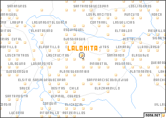
La Lomita (Copán, Honduras)La Lomita is a town in the Copán region of Honduras. An overview map of the region around La Lomita is displayed below.
regional and 3d topo map of La Lomita, Honduras ::
La Lomita airports ::
The nearest airport is SAP - San Pedro Sula La Mesa Intl, located 128.2 km north east of La Lomita.
Other airports nearby include SAL - San Salvador El Salvador Intl (138.4 km south), TGU - Tegucigalpa Toncontin Intl (183.4 km east), GUA - Guatemala City La Aurora (186.3 km west), TEA - Tela (187.9 km north east), Nearby towns ::
El Barbasco (0.0km north) //
Yaguaconte (0.0km north) //
Plan del Cuero (1.9km north) //
El Níspero (1.9km north) //
El Guayabo (1.9km south) //
Casa Quemada (1.8km west) //
Gualtaya (2.6km north west) //
Rostrojo Grande (2.6km north east) //
El Bálsamo (2.6km south east) //
El Matasano (2.6km south east) //
Ajagual (2.6km south east) //
Camalote (3.6km east) //
Viga Atravesada (3.6km west) //
El Hornito (3.6km west) //
Las Lajitas (4.0km north east) //
Pinabetal (4.0km south east) //
Ojos de Agua (4.1km north west) //
Planes de Abajo (4.0km south west) //
Planes de Arriba (4.1km south west) //
El Higón (4.1km south west) //
Laguna Seca (5.2km north west) //
Los Lesquines (5.2km south west) //
El Tránsito (5.4km west) //
Las Crucitas (5.4km west) //
El Plan de Yaunara (5.6km south) //
Talnetes (5.7km east) //
El Metal Grande (5.7km west) //
Los Planes (5.7km east) //
Esquinqual (5.8km north) //
[all distances 'as the bird flies' and approximate] 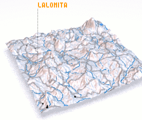 Places with similar names to La Lomita, Honduras ::
// La Lomita (PA)
// La Alameda (ES)
// La Alameda (ES)
// La Alameda (ES)
// La Alameda (ES)
// La Alameda (ES)
// La Olmeda (ES)
// La Olmeda (ES)
// La Alameda (CO)
// La Lomita (CO)
Disclaimer :: Information on this page comes without warranty of any kind |
||
|
Where is La Lomita? Elevation and coordinates ::
Latitude (lat): 14°40'0"N Longitude (lon): 88°48'0"W
Elevation (approx.): 1144m (map arrows pan, magnifying glasses zoom) |
||
|
Visiting La Lomita? Hotel/Accommodation ::
Book a hotel in La Lomita Travel Guide ::
Buy a travel guide for Honduras rental cars ::
car rental offers GPS waypoint ::
download a GPX waypoint (PoI) of La Lomita for your GPS receiver
|
||