|
search place name
|
||
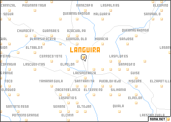
Languira (Intibucá, Honduras)Languira is a town in the Intibucá region of Honduras. An overview map of the region around Languira is displayed below.
regional and 3d topo map of Languira, Honduras ::
Languira airports ::
The nearest airport is TGU - Tegucigalpa Toncontin Intl, located 108.6 km east of Languira.
Other airports nearby include SAP - San Pedro Sula La Mesa Intl (127.0 km north), SAL - San Salvador El Salvador Intl (136.5 km south west), TEA - Tela (176.8 km north east), LCE - La Ceiba Goloson Intl (211.6 km north east), Nearby towns ::
El Zacatal (1.8km west) //
Intibucá (2.6km south east) //
La Esperanza (3.7km south) //
Barrio Llano de La Virgen (4.0km south east) //
El Pelón (4.0km south west) //
Guangololo (4.1km north west) //
Maracía (5.2km north east) //
El Peloncito de Ologosi (5.4km east) //
Quiaterique (5.6km south) //
Santa Anita (5.6km south) //
La Zilimania (5.7km east) //
El Carrizal (5.8km south) //
Azacualpa (5.8km north) //
Chiligatoro (6.6km south east) //
Los Planes (6.5km north west) //
Azacualpa de Yamaranguila (6.6km north west) //
Las Flores (7.2km east) //
Cerro Coyote (7.2km west) //
El Obelisco (7.6km south) //
El Terrero (7.6km south) //
San José (7.4km east) //
Pueblo Viejo (7.7km south east) //
Chogola (7.7km south east) //
Zacate Blanco (8.2km south west) //
El Membrillo (9.2km south west) //
Santa Catarina (9.2km south east) //
Yamaranguila (9.1km south west) //
Guansaes (9.1km north west) //
Silimania (10.3km south east) //
[all distances 'as the bird flies' and approximate]  Places with similar names to Languira, Honduras ::
Disclaimer :: Information on this page comes without warranty of any kind |
||
|
Where is Languira? Elevation and coordinates ::
Latitude (lat): 14°20'0"N Longitude (lon): 88°11'0"W
Elevation (approx.): 1858m (map arrows pan, magnifying glasses zoom) |
||
|
Visiting Languira? Hotel/Accommodation ::
Book a hotel in Languira Travel Guide ::
Buy a travel guide for Honduras rental cars ::
car rental offers GPS waypoint ::
download a GPX waypoint (PoI) of Languira for your GPS receiver
|
||