|
search place name
|
||
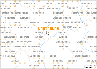
Las Tablas (Francisco Morazán, Honduras)Las Tablas is a town in the Francisco Morazán region of Honduras. An overview map of the region around Las Tablas is displayed below.
regional and 3d topo map of Las Tablas, Honduras ::
Las Tablas airports ::
The nearest airport is TGU - Tegucigalpa Toncontin Intl, located 28.2 km north west of Las Tablas.
Other airports nearby include SAP - San Pedro Sula La Mesa Intl (199.9 km north west), MGA - Managua Intl (212.7 km south east), LCE - La Ceiba Goloson Intl (212.9 km north), SAL - San Salvador El Salvador Intl (216.0 km west), Nearby towns ::
San Pedro (1.9km south) //
El Bambayonal (1.9km south) //
Las Milpas (1.9km south) //
El Terrero (1.9km south) //
Aguacate (1.9km south) //
San Pedrito (1.9km south) //
Rodeo Grande (1.9km north) //
La Uvilla (1.8km west) //
Paso Ganado (1.8km west) //
Terreritos (2.6km south west) //
Cerro Colorado (2.6km south west) //
Terrero Blanco (2.6km north west) //
Los Rincones (2.6km north west) //
Salalica (3.6km west) //
Paso Hondo (3.7km north) //
El Reducto (4.0km south east) //
El Otro Lado (4.0km south east) //
Los Suyates (4.0km south east) //
El Rincón (4.0km south west) //
Agua Caliente (5.2km south west) //
El Encinal (5.4km east) //
La Rinconada (5.4km east) //
Barajana (5.4km west) //
El Horno (5.7km east) //
Agua Tibia (5.7km east) //
El Quiquisque (5.7km east) //
Coato (6.5km south east) //
Las Quebradas (6.5km south east) //
Cañada Grande (6.5km south east) //
[all distances 'as the bird flies' and approximate] 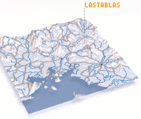 Places with similar names to Las Tablas, Honduras ::
// Las Tablas (PA)
// Las Tablas (PA)
// Las Tablas (CU)
// Los Atabales (CU)
// Las Tablas (ES)
// Las Tablas (US)
// Las Tablas (CL)
// Las Tablas (SV)
// Las Tablas (SV)
// Las Tablas (SV)
Disclaimer :: Information on this page comes without warranty of any kind |
||
|
Where is Las Tablas? Elevation and coordinates ::
Latitude (lat): 13°50'0"N Longitude (lon): 87°6'0"W
Elevation (approx.): 794m (map arrows pan, magnifying glasses zoom) |
||
|
Visiting Las Tablas? Hotel/Accommodation ::
Book a hotel in Las Tablas Travel Guide ::
Buy a travel guide for Honduras rental cars ::
car rental offers GPS waypoint ::
download a GPX waypoint (PoI) of Las Tablas for your GPS receiver
|
||