|
search place name
|
||
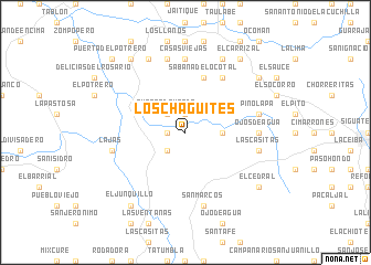
Los Chagüites (Comayagua, Honduras)Los Chagüites is a town in the Comayagua region of Honduras. An overview map of the region around Los Chagüites is displayed below.
regional and 3d topo map of Los Chagüites, Honduras ::
Los Chagüites airports ::
The nearest airport is SAP - San Pedro Sula La Mesa Intl, located 94.7 km north of Los Chagüites.
Other airports nearby include TGU - Tegucigalpa Toncontin Intl (103.4 km south east), TEA - Tela (141.8 km north east), SAL - San Salvador El Salvador Intl (171.6 km south west), LCE - La Ceiba Goloson Intl (176.6 km north east), Nearby towns ::
Cristo Rey (1.9km north) //
Terrero Blanco (1.8km west) //
Quebrada Honda (2.6km north west) //
San Rafael (2.6km south west) //
El Chaparral (2.6km north west) //
El Hobo (2.6km north west) //
La Cidra (3.6km east) //
Sabana del Ocotal (5.8km north) //
El Peñón (6.6km north east) //
Ojos de Agua (7.2km east) //
Casas Viejas (7.4km north) //
Las Casitas (7.4km east) //
El Rincón (7.4km east) //
Pinolapa (7.4km east) //
La Angostura (7.4km east) //
Lajas (7.4km west) //
San Marcos (7.6km south) //
El Palechito (7.6km north) //
Camalotales (8.2km north east) //
Los Anices (8.2km north west) //
El Junquillo (9.2km south west) //
El Cedral (9.1km south east) //
Chagüitón (9.2km north east) //
El Pital (9.2km north west) //
El Carrizal (9.2km north east) //
Higuerones (9.2km north west) //
El Saciadero (9.1km north east) //
Montañuelas (9.1km north east) //
El Zarzal (10.3km north west) //
[all distances 'as the bird flies' and approximate] 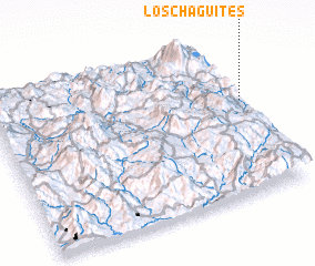 Places with similar names to Los Chagüites, Honduras ::
// Las Guaquitas (PA)
// Los Coquitos (CU)
// Los Coquitos (CU)
// Las Chiquitas (CO)
// Los Aguacates (CO)
// Los Coquitos (CO)
// Los Chagüites (SV)
// Los Chagüites (GT)
// Los Aguacates (MX)
// Los Aguacates (HN)
Disclaimer :: Information on this page comes without warranty of any kind |
||
|
Where is Los Chagüites? Elevation and coordinates ::
Latitude (lat): 14°36'0"N Longitude (lon): 88°0'0"W
Elevation (approx.): 924m (map arrows pan, magnifying glasses zoom) |
||
|
Visiting Los Chagüites? Hotel/Accommodation ::
Book a hotel in Los Chagüites Travel Guide ::
Buy a travel guide for Honduras rental cars ::
car rental offers GPS waypoint ::
download a GPX waypoint (PoI) of Los Chagüites for your GPS receiver
|
||