|
search place name
|
||
Santa Elena (Choluteca, Honduras)Santa Elena is a town in the Choluteca region of Honduras. An overview map of the region around Santa Elena is displayed below.
regional and 3d topo map of Santa Elena, Honduras ::

Santa Elena airports ::
The nearest airport is TGU - Tegucigalpa Toncontin Intl, located 80.6 km north of Santa Elena.
Other airports nearby include MGA - Managua Intl (176.6 km south east), SAL - San Salvador El Salvador Intl (195.9 km west), Nearby towns ::
Hacienda Santa Elena (0.0km north) //
Hacienda La Flor (1.1km south west) //
Hacienda Gracias a Dios (1.7km south) //
La Leona (1.8km east) //
Hacienda Santa Fe (2.2km south) //
El Papalón (2.3km south west) //
Cerro Pencos (2.6km south west) //
Palo Herrado (2.6km north west) //
Hacienda La Colama (2.6km south) //
La Pintada (3.5km south) //
Lajero Blanco (3.5km west) //
Copal Abajo (3.7km north) //
La Damiána (3.7km south west) //
Hacienda El Casco (4.1km south west) //
Ola (4.0km west) //
Balastera (4.2km south) //
El Duende (4.4km south west) //
Las Delicias (4.6km west) //
San Pablo (5.0km south) //
Hacienda El Ingles (5.1km south) //
Chamboroto (5.1km south west) //
Iztoca (5.1km east) //
Las Peñitas (5.1km south west) //
El Marillal (5.2km north west) //
La Lujosa (5.3km west) //
La Escondida (5.3km west) //
Hacienda Himitos (5.5km south east) //
Hacienda La Purísima (5.6km south west) //
Hato Nuevo (5.7km east) //
[all distances 'as the bird flies' and approximate] 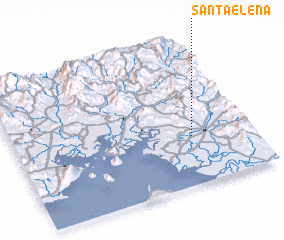 Places with similar names to Santa Elena, Honduras ::
// Sondalin (MM)
// Santa Elena (BZ)
// Saint Leon (US)
// Santa Elena (PA)
// Santa Elena (PA)
// Sandálion (GR)
// Santa Elena (CU)
// Santa Elena (CU)
// Santa Elena (CU)
// Santa Elena (CU)
Disclaimer :: Information on this page comes without warranty of any kind |
||
|
Where is Santa Elena? Elevation and coordinates ::
Latitude (lat): 13°20'0"N Longitude (lon): 87°15'0"W
Elevation (approx.): 35m (map arrows pan, magnifying glasses zoom) |
||
|
Visiting Santa Elena? Hotel/Accommodation ::
Book a hotel in Santa Elena Travel Guide ::
Buy a travel guide for Honduras rental cars ::
car rental offers GPS waypoint ::
download a GPX waypoint (PoI) of Santa Elena for your GPS receiver
|
||