|
search place name
|
||
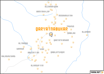
Qaryat Nābūkar (Gharyān, Libya)Qaryat Nābūkar is a town in the Gharyān region of Libya. An overview map of the region around Qaryat Nābūkar is displayed below.
regional and 3d topo map of Qaryat Nābūkar, Libya ::
Qaryat Nābūkar airports ::
The nearest airport is TIP - Tripoli Intl, located 57.0 km north of Qaryat Nābūkar.
Nearby towns ::
Qabīlat Badarthan (1.1km north east) //
As Saqāʼif (1.3km south west) //
Qabīlat an Naţţāţāt (2.0km south) //
Gharyān (2.1km north west) //
Kammūn (2.6km south) //
Barāshīn (2.7km south west) //
Al Qawāsim (3.2km north east) //
Awlād ‘Alī (3.1km west) //
Al Qābil (4.0km north) //
Awlād ‘Azzām (3.5km south west) //
Qaryat Marwān (3.8km south east) //
Awlād Bū Raʼs (4.2km north east) //
Al Kashālifah (4.6km south) //
An Nakhlayn (4.7km north) //
Al Lamāmīsh (4.2km north east) //
Bin Yaḩyá (4.6km south west) //
Awlād Bin Ya‘qūb (4.4km west) //
Awlād Manşūr (5.2km north) //
Al Jawāhilīyah (5.3km north) //
Al Qaḩāşāt (5.2km south) //
Awlād Sālim (5.5km north) //
Awlād Jarbū‘ (5.0km north east) //
Ad Dayāsīr (5.0km west) //
Qaryat Qārāt (5.5km north east) //
Taghrinnah (5.2km south west) //
Az Zuwayyah (5.9km south) //
Qabīlat al Ḩājj ‘Umrān (5.7km south west) //
Ki‘ām (6.3km south west) //
Qaryat Awlād Jamā‘ah (6.7km north) //
[all distances 'as the bird flies' and approximate] 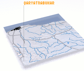 Places with similar names to Qaryat Nābūkar, Libya :: Disclaimer :: Information on this page comes without warranty of any kind |
||
|
Where is Qaryat Nābūkar? Elevation and coordinates ::
Latitude (lat): 32°9'37"N Longitude (lon): 13°2'15"E
Elevation (approx.): 680m (map arrows pan, magnifying glasses zoom) |
||
|
Visiting Qaryat Nābūkar? Hotel/Accommodation ::
Book a hotel in Qaryat Nābūkar Travel Guide ::
Buy a travel guide for Libya rental cars ::
car rental offers GPS waypoint ::
download a GPX waypoint (PoI) of Qaryat Nābūkar for your GPS receiver
|
||