|
search place name
|
||
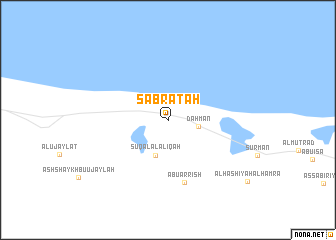
Şabrātah (Baladīyat an Nuqāţ al Khams, Libya)Şabrātah is a town in the Baladīyat an Nuqāţ al Khams region of Libya. An overview map of the region around Şabrātah is displayed below.
regional and 3d topo map of Şabrātah, Libya ::
Şabrātah airports ::
The nearest airport is TIP - Tripoli Intl, located 64.8 km east of Şabrātah.
Other airports nearby include DJE - Djerba Zarzis (199.4 km north west), SFA - Sfax Thyna (270.6 km north west), Nearby towns ::
Dahmān (2.9km east) //
Sūq al ‘Alāliqah (4.1km south) //
Abū ar Rīsh (7.2km south) //
Al Ḩāshiyah al Ḩamrāʼ (10.1km south east) //
[all distances 'as the bird flies' and approximate] 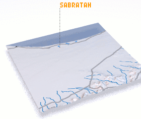 Places with similar names to Şabrātah, Libya ::
Disclaimer :: Information on this page comes without warranty of any kind |
||
|
Where is Şabrātah? Elevation and coordinates ::
Latitude (lat): 32°47'31"N Longitude (lon): 12°29'5"E
Elevation (approx.): 13m (map arrows pan, magnifying glasses zoom) |
||
|
Visiting Şabrātah? Hotel/Accommodation ::
Book a hotel in Şabrātah Travel Guide ::
Buy a travel guide for Libya rental cars ::
car rental offers GPS waypoint ::
download a GPX waypoint (PoI) of Şabrātah for your GPS receiver
|
||