|
search place name
|
||
Sūq al Aḩad (Ţarābulus, Libya)Sūq al Aḩad is a town in the Ţarābulus region of Libya. An overview map of the region around Sūq al Aḩad is displayed below.
regional and 3d topo map of Sūq al Aḩad, Libya ::

Sūq al Aḩad airports ::
The nearest airport is TIP - Tripoli Intl, located 29.3 km north west of Sūq al Aḩad.
Nearby towns ::
[all distances 'as the bird flies' and approximate] 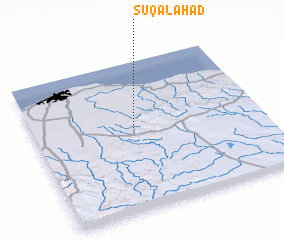 Places with similar names to Sūq al Aḩad, Libya ::
// Skullhead (US)
// Schloyheide (DE)
// Schöllhütte (DE)
// Sūq al Aḩad (SA)
// Sūq al Aḩad (SA)
// Souk el Had (MA)
// Souk el Had (MA)
// Souk el Had (MA)
// Souk el Had (MA)
// Souk el Had (DZ)
Disclaimer :: Information on this page comes without warranty of any kind |
||
|
Where is Sūq al Aḩad? Elevation and coordinates ::
Latitude (lat): 32°33'6"N Longitude (lon): 13°26'31"E
Elevation (approx.): 192m (map arrows pan, magnifying glasses zoom) |
||
|
Visiting Sūq al Aḩad? Hotel/Accommodation ::
Book a hotel in Sūq al Aḩad Travel Guide ::
Buy a travel guide for Libya rental cars ::
car rental offers GPS waypoint ::
download a GPX waypoint (PoI) of Sūq al Aḩad for your GPS receiver
|
||