|
search place name
|
||
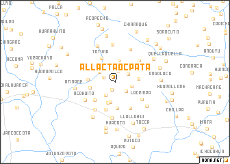
Allactaocpata (Arequipa, Peru)Allactaocpata is a town in the Arequipa region of Peru. An overview map of the region around Allactaocpata is displayed below.
regional and 3d topo map of Allactaocpata, Peru ::
Allactaocpata airports ::
The nearest airport is AQP - Arequipa Rodriguez Ballon, located 73.9 km south west of Allactaocpata.
Other airports nearby include JUL - Juliaca (119.1 km east), Nearby towns ::
Amayane (1.4km south) //
Huito (1.9km west) //
Pucrotaña (2.0km north) //
Canchacaca (2.3km south east) //
Nuñule (2.4km north east) //
Huangane (2.6km south west) //
Ichocahua (2.7km east) //
Caque (2.9km north west) //
Coycotera (3.2km north) //
Quese Quese (3.3km north east) //
Picotane (3.4km south) //
Huilaconcore (3.5km north) //
Llotarane (3.6km south) //
Huarallalla (3.7km east) //
Pumanuta (4.1km west) //
Pilloniya (4.3km south) //
Totuma (4.3km north west) //
Laerutaña (4.2km west) //
Sihuacollo (4.3km south west) //
Japutaña (4.3km north west) //
Acomayo (4.8km south) //
Vizcachane (4.9km south east) //
Lacrimpa (5.1km south east) //
Carhuañune (5.1km north east) //
Quese Quese (5.5km south west) //
Acohuito (5.6km south west) //
Chulluhuire (5.8km north east) //
Chanca (5.9km south) //
Tacamani (6.1km north) //
[all distances 'as the bird flies' and approximate]  Places with similar names to Allactaocpata, Peru :: Disclaimer :: Information on this page comes without warranty of any kind |
||
|
Where is Allactaocpata? Elevation and coordinates ::
Latitude (lat): 15°46'13"S Longitude (lon): 71°13'27"W
Elevation (approx.): 4483m (map arrows pan, magnifying glasses zoom) |
||
|
Visiting Allactaocpata? Hotel/Accommodation ::
Book a hotel in Allactaocpata Travel Guide ::
Buy a travel guide for Peru rental cars ::
car rental offers GPS waypoint ::
download a GPX waypoint (PoI) of Allactaocpata for your GPS receiver
|
||