|
search place name
|
||
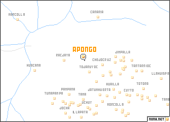
Apongo (Ayacucho, Peru)Apongo is a town in the Ayacucho region of Peru. An overview map of the region around Apongo is displayed below.
regional and 3d topo map of Apongo, Peru ::
Apongo airports ::
The nearest airport is ANS - Andahuaylas, located 71.6 km north east of Apongo.
Other airports nearby include AYP - Ayacucho Coronel Fap Alfredo Mendivil Duarte (99.6 km north), CUZ - Cuzco Teniente Alejandro Velasco Astete Intl (222.1 km east), Nearby towns ::
Tojaruyoc (2.6km south) //
Chejo Cruz (3.9km east) //
Racjaya (4.5km west) //
Obraje (4.9km south east) //
Asquipata (5.1km south east) //
HuaytaHuerta (5.9km south east) //
Teloro (6.4km south east) //
Hacienda San José (6.5km east) //
Pucarpata (6.7km east) //
Pato (7.6km east) //
Pampana (8.0km south west) //
Jatum Huerta (8.1km south east) //
Pallja (8.0km east) //
Cachi (8.2km east) //
Tama (8.5km south) //
Chancure (8.3km east) //
Jimpalla (8.4km east) //
Tacta (8.4km east) //
Huailla (8.7km south east) //
Minuna (8.7km east) //
Condorjojo (9.0km south east) //
Huaija Huaijo (9.6km south east) //
Eranja (10.0km south west) //
Tintay (10.1km south east) //
Pihuallio (10.2km south east) //
Tunapampa (10.5km south west) //
[all distances 'as the bird flies' and approximate]  Places with similar names to Apongo, Peru ::
Disclaimer :: Information on this page comes without warranty of any kind |
||
|
Where is Apongo? Elevation and coordinates ::
Latitude (lat): 14°0'53"S Longitude (lon): 73°55'59"W
Elevation (approx.): 3092m (map arrows pan, magnifying glasses zoom) |
||
|
Visiting Apongo? Hotel/Accommodation ::
Book a hotel in Apongo Travel Guide ::
Buy a travel guide for Peru rental cars ::
car rental offers GPS waypoint ::
download a GPX waypoint (PoI) of Apongo for your GPS receiver
|
||