|
search place name
|
||
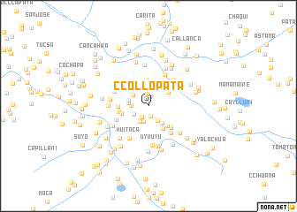
Ccollopata (Cusco, Peru)Ccollopata is a town in the Cusco region of Peru. An overview map of the region around Ccollopata is displayed below.
regional and 3d topo map of Ccollopata, Peru ::
Ccollopata airports ::
The nearest airport is CUZ - Cuzco Teniente Alejandro Velasco Astete Intl, located 113.2 km north west of Ccollopata.
Other airports nearby include JUL - Juliaca (174.5 km south east), PEM - Puerto Maldonado Padre Aldamiz (278.4 km north east), Nearby towns ::
Catacunca (1.2km north) //
Ccellocunca (1.3km south) //
Marcani (1.5km north) //
Pucyupucyu (1.6km south west) //
Molloccata (2.1km south) //
Oquemocco (2.1km south west) //
Pucjio Pucjio Pata (2.1km south east) //
Ccacachaca (2.1km west) //
Quisca Loma (2.2km south west) //
Pallca Pata (2.3km north) //
Pata Palla (2.3km north west) //
Malcurumi (2.5km west) //
Japu Pampa (2.6km north) //
Sillota (2.5km west) //
Cuncapata (2.7km south east) //
Chayhuani (2.9km north east) //
Jacuni (3.0km north east) //
Cancahuapata (3.3km north) //
Joruroccata (3.4km south east) //
Chaynani (3.4km south east) //
Sacuyo (3.4km west) //
Patapata (3.7km west) //
Mojón (3.8km west) //
Capillapata (3.9km south east) //
Baños Uyurmiri (4.2km north west) //
San Felipe (4.3km south west) //
Llocllata (4.4km north east) //
Poccopoquella (4.4km south east) //
Viluyo (4.4km north east) //
[all distances 'as the bird flies' and approximate] 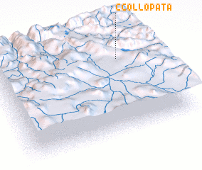 Places with similar names to Ccollopata, Peru :: Disclaimer :: Information on this page comes without warranty of any kind |
||
|
Where is Ccollopata? Elevation and coordinates ::
Latitude (lat): 14°14'47"S Longitude (lon): 71°11'7"W
Elevation (approx.): 4070m (map arrows pan, magnifying glasses zoom) |
||
|
Visiting Ccollopata? Hotel/Accommodation ::
Book a hotel in Ccollopata Travel Guide ::
Buy a travel guide for Peru rental cars ::
car rental offers GPS waypoint ::
download a GPX waypoint (PoI) of Ccollopata for your GPS receiver
|
||