|
search place name
|
||
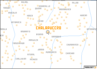
Chalapuccro (Pasco, Peru)Chalapuccro is a town in the Pasco region of Peru. An overview map of the region around Chalapuccro is displayed below.
regional and 3d topo map of Chalapuccro, Peru ::
Chalapuccro airports ::
The nearest airport is ATA - Anta Comandante Fap German Arias Graziani, located 190.0 km north west of Chalapuccro.
Other airports nearby include LIM - Lima Jorge Chavez Intl (203.9 km south west), Nearby towns ::
Yaracrume (0.9km north east) //
Pallanchacra (2.0km south west) //
Visca (2.1km south west) //
Salcachupan (2.4km north east) //
Torococha (2.4km north east) //
Punta (2.4km south east) //
La Curva (3.2km south) //
Ingenio (3.3km west) //
Supica (3.5km north east) //
San Roque (3.7km south east) //
Racquia (3.9km north east) //
Maraunina (4.0km south) //
Hacienda Huanacchaca (4.2km south east) //
Chincoj (4.3km north) //
San Juan (4.6km north east) //
Hacienca Pucara (4.6km north east) //
Umapancuy (4.8km south west) //
Millpo (4.8km north west) //
Fundicíon (5.0km south) //
Cayan (5.0km north west) //
Jatahogo (5.0km north) //
Ingenio (5.0km north west) //
Cochacalla (5.0km north east) //
Iscurrume (5.0km north east) //
San Pedro de Pillao (5.3km north) //
Canish (5.4km south east) //
Huichpín (5.5km south) //
Anyay (5.7km north east) //
Jarcahuaca (5.7km south east) //
[all distances 'as the bird flies' and approximate]  Places with similar names to Chalapuccro, Peru :: Disclaimer :: Information on this page comes without warranty of any kind |
||
|
Where is Chalapuccro? Elevation and coordinates ::
Latitude (lat): 10°23'56"S Longitude (lon): 76°13'43"W
Elevation (approx.): 2930m (map arrows pan, magnifying glasses zoom) |
||
|
Visiting Chalapuccro? Hotel/Accommodation ::
Book a hotel in Chalapuccro Travel Guide ::
Buy a travel guide for Peru rental cars ::
car rental offers GPS waypoint ::
download a GPX waypoint (PoI) of Chalapuccro for your GPS receiver
|
||