|
search place name
|
||
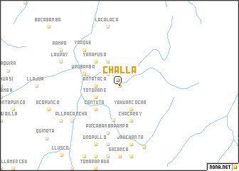
Challa (Cusco, Peru)Challa is a town in the Cusco region of Peru. An overview map of the region around Challa is displayed below.
regional and 3d topo map of Challa, Peru ::
Challa airports ::
The nearest airport is CUZ - Cuzco Teniente Alejandro Velasco Astete Intl, located 77.9 km north of Challa.
Other airports nearby include ANS - Andahuaylas (153.8 km west), JUL - Juliaca (243.6 km south east), Nearby towns ::
Cascabamba (0.0km north) //
Armería (0.0km north) //
Jaccara (2.6km north west) //
Antataca (3.6km west) //
Canchero (4.1km north west) //
Parcobamba (4.1km north west) //
Yahuarcocha (4.1km south east) //
Totorane (4.0km south west) //
Yanafusa (5.2km north west) //
Cantuta (5.2km south west) //
Colquemarca (5.5km south) //
Chacaray (5.8km south) //
Urubamba (5.7km west) //
Charamoray (5.7km west) //
Pircabambapampa (7.6km south) //
Yarque (7.7km north west) //
Allpacancha (9.1km south west) //
[all distances 'as the bird flies' and approximate] 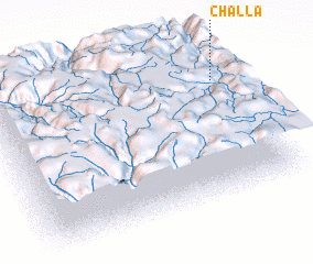 Places with similar names to Challa, Peru ::
Disclaimer :: Information on this page comes without warranty of any kind |
||
|
Where is Challa? Elevation and coordinates ::
Latitude (lat): 14°14'0"S Longitude (lon): 72°2'0"W
Elevation (approx.): 3498m (map arrows pan, magnifying glasses zoom) |
||
|
Visiting Challa? Hotel/Accommodation ::
Book a hotel in Challa Travel Guide ::
Buy a travel guide for Peru rental cars ::
car rental offers GPS waypoint ::
download a GPX waypoint (PoI) of Challa for your GPS receiver
|
||