|
search place name
|
||
Chaupitiana (Puno, Peru)Chaupitiana is a town in the Puno region of Peru. An overview map of the region around Chaupitiana is displayed below.
regional and 3d topo map of Chaupitiana, Peru ::

Chaupitiana airports ::
The nearest airport is JUL - Juliaca, located 136.9 km south west of Chaupitiana.
Other airports nearby include PEM - Puerto Maldonado Padre Aldamiz (195.3 km north), Nearby towns ::
Pilicani (4.0km south) //
Tjune (4.5km south) //
Chaupiayllu (4.6km south) //
Chimi Pata (4.6km north east) //
Punayllu (6.0km south) //
Patambuco (6.0km south east) //
Canu Canu (6.6km south) //
Quehare (7.2km south) //
Cantotani (7.1km east) //
Joñeline (7.2km south east) //
Quebrada Ancantera (7.7km north west) //
Jarahuaña (8.2km south east) //
Cahuichaña (8.5km north) //
Suca Suca (8.6km south east) //
Carabarcuna (8.7km south) //
Cruz Pata (9.6km north west) //
Tiraca (9.6km north east) //
Laguna Valsacocha (10.0km north west) //
Tranca Pata (10.2km north west) //
Challhuani (10.5km south west) //
Huarajoni (10.6km south east) //
Lahuaña (10.9km south west) //
Pichajani (11.5km north west) //
[all distances 'as the bird flies' and approximate] 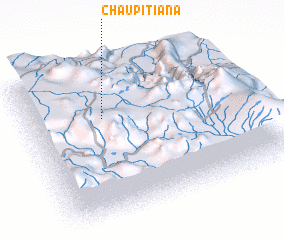 Places with similar names to Chaupitiana, Peru ::
// Shipochane (BG)
// Shipochano (BG)
// Chaupichana (PE)
// Chipchane (PE)
// Chŏp-ch'on (KR)
// Chapushan (CN)
// Shipochen (CN)
// Shapechino (BY)
// Shipichnyy (RU)
// Shipichnyy (RU)
Disclaimer :: Information on this page comes without warranty of any kind |
||
|
Where is Chaupitiana? Elevation and coordinates ::
Latitude (lat): 14°19'37"S Longitude (lon): 69°39'47"W
Elevation (approx.): 4417m (map arrows pan, magnifying glasses zoom) |
||
|
Visiting Chaupitiana? Hotel/Accommodation ::
Book a hotel in Chaupitiana Travel Guide ::
Buy a travel guide for Peru rental cars ::
car rental offers GPS waypoint ::
download a GPX waypoint (PoI) of Chaupitiana for your GPS receiver
|
||