|
search place name
|
||
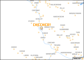
Chicchicay (Lima, Peru)Chicchicay is a town in the Lima region of Peru. An overview map of the region around Chicchicay is displayed below.
regional and 3d topo map of Chicchicay, Peru ::
Chicchicay airports ::
The nearest airport is PIO - Pisco Intl, located 116.7 km south of Chicchicay.
Other airports nearby include LIM - Lima Jorge Chavez Intl (148.2 km north west), AYP - Ayacucho Coronel Fap Alfredo Mendivil Duarte (195.7 km east), Nearby towns ::
Quirman (1.8km south west) //
Capillucas (2.6km north west) //
Chavín (2.6km south east) //
Pampuytaca (3.2km east) //
Ucallay (4.2km north) //
Espuy (4.3km south) //
Cachuy (4.3km east) //
Oyunco (5.5km north west) //
Huanca Corral (5.6km east) //
Erhuaca (6.0km north) //
San Lorenzo de Putinza (6.2km north) //
Antarco (6.5km north) //
Pacalay (7.6km north) //
Canchan (7.7km south east) //
Concubay (8.3km north) //
Mallay (8.3km south east) //
Huachicocha (8.9km north east) //
Acupampa (9.3km south east) //
Tacuasi (10.1km south east) //
Cacacho (10.3km south east) //
Comunidad (10.3km south east) //
Monte (10.4km south east) //
Catahuasi (10.7km south east) //
[all distances 'as the bird flies' and approximate]  Places with similar names to Chicchicay, Peru ::
// Chaqchaq (IQ)
// Shakshūk (EG)
// Chah Kūshk (IR)
// Chak Chak (IR)
// Chak Chaki (BD)
// Chocchoc (GT)
// Chakchoka (IN)
// Chagueachic (MX)
// Chak Chak (SD)
// Choko Choko (ZM)
Disclaimer :: Information on this page comes without warranty of any kind |
||
|
Where is Chicchicay? Elevation and coordinates ::
Latitude (lat): 12°43'24"S Longitude (lon): 75°57'12"W
Elevation (approx.): 1465m (map arrows pan, magnifying glasses zoom) |
||
|
Visiting Chicchicay? Hotel/Accommodation ::
Book a hotel in Chicchicay Travel Guide ::
Buy a travel guide for Peru rental cars ::
car rental offers GPS waypoint ::
download a GPX waypoint (PoI) of Chicchicay for your GPS receiver
|
||