|
search place name
|
||
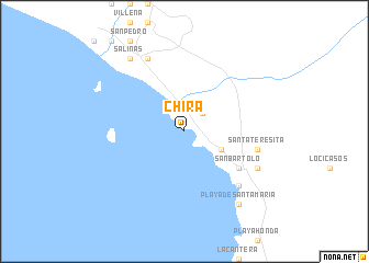
Chira (Lima, Peru)Chira is a town in the Lima region of Peru. An overview map of the region around Chira is displayed below.
regional and 3d topo map of Chira, Peru ::
Chira airports ::
The nearest airport is LIM - Lima Jorge Chavez Intl, located 47.5 km north west of Chira.
Other airports nearby include PIO - Pisco Intl (168.0 km south east), Nearby towns ::
Punta Hermosa (2.6km north east) //
Punta Negra (4.1km south east) //
San Bartolo (6.6km south east) //
Santa Teresita (7.5km east) //
Quebrada Seca (7.8km south east) //
Casa Bomba (8.1km south east) //
Cruz de Hueso (8.1km south east) //
Lurín (8.3km north west) //
Salinas (9.2km north west) //
Playa de Santa María (9.2km south east) //
[all distances 'as the bird flies' and approximate]  Places with similar names to Chira, Peru ::
Disclaimer :: Information on this page comes without warranty of any kind |
||
|
Where is Chira? Elevation and coordinates ::
Latitude (lat): 12°21'0"S Longitude (lon): 76°50'0"W
Elevation (approx.): -32768m (map arrows pan, magnifying glasses zoom) |
||
|
Visiting Chira? Hotel/Accommodation ::
Book a hotel in Chira Travel Guide ::
Buy a travel guide for Peru rental cars ::
car rental offers GPS waypoint ::
download a GPX waypoint (PoI) of Chira for your GPS receiver
|
||