|
search place name
|
||
Churajon (Arequipa, Peru)Churajon is a town in the Arequipa region of Peru. An overview map of the region around Churajon is displayed below.
regional and 3d topo map of Churajon, Peru ::

Churajon airports ::
The nearest airport is AQP - Arequipa Rodriguez Ballon, located 43.3 km north west of Churajon.
Other airports nearby include JUL - Juliaca (181.9 km north east), TCQ - Tacna Coronel Carlos Ciriani Santa Rosa Intl (191.7 km south east), ARI - Arica Chacalluta (215.6 km south east), Nearby towns ::
Siete Toldos (1.3km south west) //
Segache (2.1km south east) //
Paranay (3.2km north east) //
Tasata Baja (3.8km east) //
Tasata Alta (4.7km east) //
Corahuaya (5.7km east) //
Caitanuyoc (6.1km north west) //
San José de Uzuña (7.5km north) //
Carrizal (7.7km north west) //
Chapi (7.8km south) //
Usuña (9.0km north) //
Hacienda Chávez (9.3km north west) //
Hospicio (10.6km north east) //
La Apacheta de Talamolle (11.3km north east) //
[all distances 'as the bird flies' and approximate] 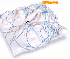 Places with similar names to Churajon, Peru ::
// Sharjān (IQ)
// Chārjān (IR)
// Char Ruijāni (BD)
// Shrjan (IN)
// Shīreh Jīn (IR)
// Charijón (PE)
// Shirgin (TJ)
// Sharygino (RU)
// Shurygino (RU)
// Shirjan (YE)
Disclaimer :: Information on this page comes without warranty of any kind |
||
|
Where is Churajon? Elevation and coordinates ::
Latitude (lat): 16°39'8"S Longitude (lon): 71°20'12"W
Elevation (approx.): 3160m (map arrows pan, magnifying glasses zoom) |
||
|
Visiting Churajon? Hotel/Accommodation ::
Book a hotel in Churajon Travel Guide ::
Buy a travel guide for Peru rental cars ::
car rental offers GPS waypoint ::
download a GPX waypoint (PoI) of Churajon for your GPS receiver
|
||