|
search place name
|
||
Conga (Cajamarca, Peru)Conga is a town in the Cajamarca region of Peru. An overview map of the region around Conga is displayed below.
regional and 3d topo map of Conga, Peru ::

Conga airports ::
The nearest airport is CIX - Chiclayo Capt Jose A Quinones Gonzales Intl, located 117.0 km south west of Conga.
Other airports nearby include CHH - Chachapoyas (143.9 km east), PIU - Piura Capitan Fap Guillermo Concha Iberico (185.1 km north west), Nearby towns ::
Tumangue (3.4km south west) //
El Alvarado (3.5km south west) //
Chaupe (3.7km south west) //
Agopampa (3.8km south) //
Yambolón (3.8km north west) //
Saranguina (4.0km south) //
Las Huertas (4.2km south east) //
La Vega (4.6km south) //
Ingatambo (5.3km south) //
La Misa (5.4km east) //
Remolino (5.6km south) //
Lishinas (5.7km south) //
Conjuro (6.0km east) //
Pucará (6.2km south) //
Ayahuacas (7.0km south east) //
Corral Pampa (7.0km east) //
San Antonio (7.3km west) //
Huarango Pampa (7.7km west) //
Barbacora (7.8km south east) //
Colasay (8.1km east) //
Algarrobito (8.1km south west) //
Rumipilca (8.1km west) //
Lucto (8.4km south east) //
Chilasque (8.5km south west) //
Monteverde (8.7km west) //
Quinua (8.8km south west) //
Carrizal (9.7km north west) //
Barranco (11.6km south east) //
Atumpampa (11.9km south west) //
[all distances 'as the bird flies' and approximate] 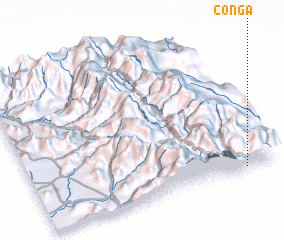 Places with similar names to Conga, Peru ::
Disclaimer :: Information on this page comes without warranty of any kind |
||
|
Where is Conga? Elevation and coordinates ::
Latitude (lat): 5°59'7"S Longitude (lon): 79°8'18"W
Elevation (approx.): 1709m (map arrows pan, magnifying glasses zoom) |
||
|
Visiting Conga? Hotel/Accommodation ::
Book a hotel in Conga Travel Guide ::
Buy a travel guide for Peru rental cars ::
car rental offers GPS waypoint ::
download a GPX waypoint (PoI) of Conga for your GPS receiver
|
||