|
search place name
|
||
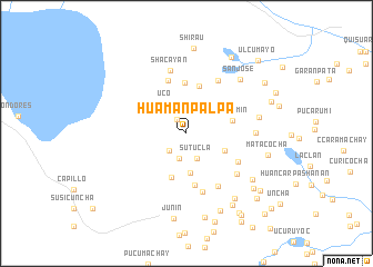
Huamanpalpa (Junín, Peru)Huamanpalpa is a town in the Junín region of Peru. An overview map of the region around Huamanpalpa is displayed below.
regional and 3d topo map of Huamanpalpa, Peru ::
Huamanpalpa airports ::
The nearest airport is LIM - Lima Jorge Chavez Intl, located 161.4 km south west of Huamanpalpa.
Other airports nearby include ATA - Anta Comandante Fap German Arias Graziani (261.2 km north west), Nearby towns ::
Shegue (1.6km north west) //
Cayahuay (2.4km south west) //
Huichcahuayin (2.6km south) //
Sutucla (2.7km south east) //
Chupanac (2.8km north west) //
Uco (3.6km north west) //
Ucushcancha (4.0km south) //
Curumura (4.1km south east) //
Pampacancha (4.7km south) //
Racramin (4.7km east) //
Pucrihuaca (4.9km north) //
Pajpan (5.1km north) //
Cayacancha (5.3km south) //
Pampahuay (5.6km north) //
Yuquiuyo (5.8km south east) //
Chacacancha (6.0km south) //
Picuicancha (6.2km north east) //
Rispangacancha (6.2km south east) //
Pisbuguquio (6.4km south east) //
Shacayán (6.5km north) //
Tauren (6.9km east) //
Alcacocha (7.3km east) //
San José (7.6km north east) //
Huaro Cancha (8.0km south east) //
Chaquicocha (8.1km south east) //
Matacocha (8.3km east) //
Chupaca (8.4km south east) //
Shirau (8.5km north) //
Casapalcca (8.5km south east) //
[all distances 'as the bird flies' and approximate] 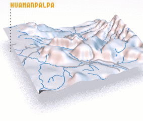 Places with similar names to Huamanpalpa, Peru :: Disclaimer :: Information on this page comes without warranty of any kind |
||
|
Where is Huamanpalpa? Elevation and coordinates ::
Latitude (lat): 11°4'57"S Longitude (lon): 75°58'54"W
Elevation (approx.): 4200m (map arrows pan, magnifying glasses zoom) |
||
|
Visiting Huamanpalpa? Hotel/Accommodation ::
Book a hotel in Huamanpalpa Travel Guide ::
Buy a travel guide for Peru rental cars ::
car rental offers GPS waypoint ::
download a GPX waypoint (PoI) of Huamanpalpa for your GPS receiver
|
||