|
search place name
|
||
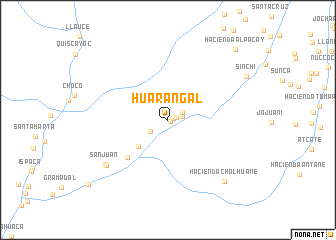
Huarangal (Arequipa, Peru)Huarangal is a town in the Arequipa region of Peru. An overview map of the region around Huarangal is displayed below.
regional and 3d topo map of Huarangal, Peru ::
Huarangal airports ::
The nearest airport is AQP - Arequipa Rodriguez Ballon, located 159.6 km east of Huarangal.
Nearby towns ::
Real (0.3km south east) //
San José (0.6km east) //
Tunal (1.0km east) //
Hacienda Chanana (1.6km east) //
Pan de Azúcar (1.8km north east) //
Santa Catalina (2.3km south west) //
Hacienda La Capilla (4.3km south west) //
Hacienda Champune (6.0km south west) //
San Juan (8.3km south west) //
Mina San Juan (8.3km south west) //
Hacienda Chalhuane (9.2km south east) //
Sinchi (9.7km north east) //
Hacienda Alpacay (10.7km north east) //
Chillihuay (11.2km south west) //
[all distances 'as the bird flies' and approximate]  Places with similar names to Huarangal, Peru ::
// Hayrangöl (TR)
// Harangul (IN)
// Haranggaul (ID)
// Horno Cal (MX)
// Harangala (LK)
// Harannagala (LK)
// Horangala (LK)
// Horangalla (LK)
// Herānkeleh (IR)
// Huarangal (PE)
Disclaimer :: Information on this page comes without warranty of any kind |
||
|
Where is Huarangal? Elevation and coordinates ::
Latitude (lat): 15°51'32"S Longitude (lon): 72°59'20"W
Elevation (approx.): 1149m (map arrows pan, magnifying glasses zoom) |
||
|
Visiting Huarangal? Hotel/Accommodation ::
Book a hotel in Huarangal Travel Guide ::
Buy a travel guide for Peru rental cars ::
car rental offers GPS waypoint ::
download a GPX waypoint (PoI) of Huarangal for your GPS receiver
|
||