|
search place name
|
||
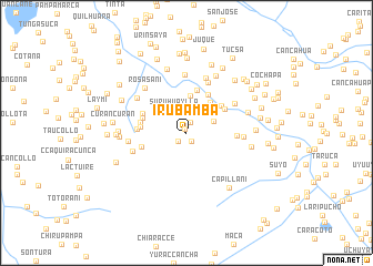
Irubamba (Cusco, Peru)Irubamba is a town in the Cusco region of Peru. An overview map of the region around Irubamba is displayed below.
regional and 3d topo map of Irubamba, Peru ::
Irubamba airports ::
The nearest airport is CUZ - Cuzco Teniente Alejandro Velasco Astete Intl, located 102.4 km north west of Irubamba.
Other airports nearby include JUL - Juliaca (185.1 km south east), Nearby towns ::
Jarroquia (0.5km north west) //
Huacrani (1.0km south east) //
Chuñupata (1.2km north) //
Chaquiri (1.2km south west) //
Huayllapampa (2.6km north) //
Suruhuaylla (2.6km north west) //
Huarocani (2.8km north east) //
Lacaya (3.7km north east) //
Rauma (3.8km north) //
Casapampa (3.9km north east) //
Chiara (4.3km north east) //
Sayhua (4.4km north east) //
Estancia Oco (4.4km north) //
Chullo (4.5km north east) //
Picotane (4.5km west) //
Uyouyo (4.5km west) //
Llantamocco (4.6km west) //
Puna Pata (4.6km north west) //
Calvario (4.7km west) //
Estuniyoc (4.8km west) //
Acce Punco (4.9km east) //
Casapampa (5.5km north east) //
Ihuayllullo (5.6km north east) //
Llallapata (5.5km west) //
Ñanraqui (5.6km east) //
Chilcani (5.8km north) //
Paricocha (5.8km north) //
Llallapata (5.7km west) //
Cuchucalla (5.9km north west) //
[all distances 'as the bird flies' and approximate] 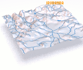 Places with similar names to Irubamba, Peru ::
// Irubamba (PE)
Disclaimer :: Information on this page comes without warranty of any kind |
||
|
Where is Irubamba? Elevation and coordinates ::
Latitude (lat): 14°15'16"S Longitude (lon): 71°20'33"W
Elevation (approx.): 3774m (map arrows pan, magnifying glasses zoom) |
||
|
Visiting Irubamba? Hotel/Accommodation ::
Book a hotel in Irubamba Travel Guide ::
Buy a travel guide for Peru rental cars ::
car rental offers GPS waypoint ::
download a GPX waypoint (PoI) of Irubamba for your GPS receiver
|
||