|
search place name
|
||
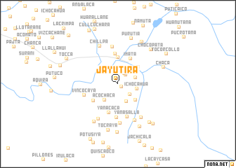
Jayutira (Arequipa, Peru)Jayutira is a town in the Arequipa region of Peru. An overview map of the region around Jayutira is displayed below.
regional and 3d topo map of Jayutira, Peru ::
Jayutira airports ::
The nearest airport is AQP - Arequipa Rodriguez Ballon, located 72.4 km south west of Jayutira.
Other airports nearby include JUL - Juliaca (111.3 km north east), Nearby towns ::
Sanincaya (0.7km south east) //
Capicollo (1.8km north east) //
Lumastaña (2.0km north east) //
Pusca Pusca (2.5km south east) //
Choco (2.9km east) //
Ichocahua (3.0km east) //
Chacala (3.1km south east) //
Acochaca (3.3km south west) //
Jancullo (3.7km south east) //
Capacaico (4.1km north east) //
Yuraccancha (4.3km north) //
Imata (4.5km north east) //
Chojona (4.6km south west) //
Yanacaca (4.8km south) //
Visacaca (4.8km north) //
Marca Marca (5.3km south) //
Yanasalla (5.5km south) //
Vincocaya (5.4km west) //
Chancacollo (5.9km north) //
San Antonio de Chuca (6.3km south) //
Herocollo (6.3km south west) //
Machane (6.4km south east) //
Llallahui (6.4km south east) //
Chillpa (6.7km north west) //
Pisca Pisca (7.1km south west) //
Tocraya (7.5km south) //
Purutia (7.5km north) //
Chocopata (7.4km north east) //
Culipugro (7.6km south east) //
[all distances 'as the bird flies' and approximate] 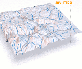 Places with similar names to Jayutira, Peru ::
// Geyeh Dar (IR)
Disclaimer :: Information on this page comes without warranty of any kind |
||
|
Where is Jayutira? Elevation and coordinates ::
Latitude (lat): 15°52'31"S Longitude (lon): 71°6'27"W
Elevation (approx.): 4494m (map arrows pan, magnifying glasses zoom) |
||
|
Visiting Jayutira? Hotel/Accommodation ::
Book a hotel in Jayutira Travel Guide ::
Buy a travel guide for Peru rental cars ::
car rental offers GPS waypoint ::
download a GPX waypoint (PoI) of Jayutira for your GPS receiver
|
||