|
search place name
|
||
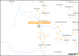
Jechjaypampa (Ayacucho, Peru)Jechjaypampa is a town in the Ayacucho region of Peru. An overview map of the region around Jechjaypampa is displayed below.
regional and 3d topo map of Jechjaypampa, Peru ::
Jechjaypampa airports ::
The nearest airport is ANS - Andahuaylas, located 97.8 km north east of Jechjaypampa.
Other airports nearby include AYP - Ayacucho Coronel Fap Alfredo Mendivil Duarte (135.1 km north), Nearby towns ::
Yarpo (2.1km south) //
Culluanayjo (2.2km south east) //
Millpupampa (2.5km south) //
Mayobamba (2.9km north east) //
Chirigri (3.4km south east) //
Andamarca (3.8km south) //
Ayaorjo (4.2km south) //
Pangapata (4.2km south east) //
Yana Jocha (4.8km south east) //
Pucapuca (5.1km south) //
Ayou (5.2km north) //
Jiruicha (5.3km south east) //
Sajrahua (5.3km south east) //
Mollacata (5.4km south) //
Jautapampa (6.6km north) //
Sondondo (6.7km north east) //
Guajraja (6.7km south) //
Cabana (7.0km north) //
Coajraga (7.2km south) //
Hacienda Huancappay (7.1km east) //
Aucara (8.2km north) //
Millupampa (8.2km north) //
Muycay (8.3km north) //
Capillayocc (8.1km east) //
Chupahuaijo (8.3km east) //
Moyobamba (8.3km east) //
Andamarca (8.6km north west) //
Checlloca (9.0km south east) //
San Juan Punco (9.4km south east) //
[all distances 'as the bird flies' and approximate]  Places with similar names to Jechjaypampa, Peru ::
// Joshjapampa (PE)
Disclaimer :: Information on this page comes without warranty of any kind |
||
|
Where is Jechjaypampa? Elevation and coordinates ::
Latitude (lat): 14°21'14"S Longitude (lon): 73°58'0"W
Elevation (approx.): 3602m (map arrows pan, magnifying glasses zoom) |
||
|
Visiting Jechjaypampa? Hotel/Accommodation ::
Book a hotel in Jechjaypampa Travel Guide ::
Buy a travel guide for Peru rental cars ::
car rental offers GPS waypoint ::
download a GPX waypoint (PoI) of Jechjaypampa for your GPS receiver
|
||