|
search place name
|
||
Kcoyajo (Arequipa, Peru)Kcoyajo is a town in the Arequipa region of Peru. An overview map of the region around Kcoyajo is displayed below.
regional and 3d topo map of Kcoyajo, Peru ::

Kcoyajo airports ::
The nearest airport is AQP - Arequipa Rodriguez Ballon, located 150.8 km south east of Kcoyajo.
Other airports nearby include ANS - Andahuaylas (206.7 km north), CUZ - Cuzco Teniente Alejandro Velasco Astete Intl (224.0 km north), Nearby towns ::
Chaupipuñuna (2.9km north east) //
Patilla (3.0km north east) //
Sora Kcasa (3.1km north) //
Arco (3.7km north east) //
Uchuy-Amayani (4.6km east) //
Purhua-Purhua (4.9km north) //
Mauca Llacta (4.9km north west) //
Toria (6.0km south east) //
Pallca (6.6km east) //
Cavalca (7.0km south east) //
Hospicio (8.0km north west) //
Cuncaicha (8.9km north east) //
Cusullo (9.2km north west) //
Pucyo-Cucho (9.9km north west) //
Purua Puruay (10.6km north east) //
[all distances 'as the bird flies' and approximate] 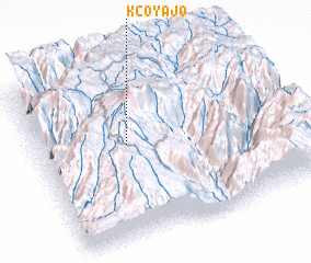 Places with similar names to Kcoyajo, Peru ::
// Kaikayaje (NG)
Disclaimer :: Information on this page comes without warranty of any kind |
||
|
Where is Kcoyajo? Elevation and coordinates ::
Latitude (lat): 15°26'30"S Longitude (lon): 72°38'27"W
Elevation (approx.): 4514m (map arrows pan, magnifying glasses zoom) |
||
|
Visiting Kcoyajo? Hotel/Accommodation ::
Book a hotel in Kcoyajo Travel Guide ::
Buy a travel guide for Peru rental cars ::
car rental offers GPS waypoint ::
download a GPX waypoint (PoI) of Kcoyajo for your GPS receiver
|
||