|
search place name
|
||
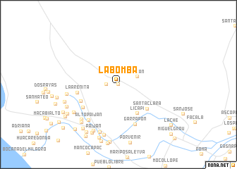
La Bomba (La Libertad, Peru)La Bomba is a town in the La Libertad region of Peru. An overview map of the region around La Bomba is displayed below.
regional and 3d topo map of La Bomba, Peru ::
La Bomba airports ::
The nearest airport is TRU - Trujillo Capitan Carlos Martinez De Pinillos, located 49.1 km south of La Bomba.
Other airports nearby include CIX - Chiclayo Capt Jose A Quinones Gonzales Intl (115.3 km north west), CHM - Chimbote Teniente Jaime A De Montreuil Morales (183.3 km south east), CHH - Chachapoyas (224.8 km north east), ATA - Anta Comandante Fap German Arias Graziani (261.3 km south east), Nearby towns ::
La Quinta (0.0km north) //
La Arenita (1.8km west) //
Mocán (3.2km east) //
Licapi (5.5km south east) //
Santa Clara (6.0km south east) //
Alto La Hilaria (6.5km south west) //
La Arenita (6.6km west) //
Chiclayito (6.6km south west) //
Garrapón (6.9km south east) //
Alto Paiján (7.3km south west) //
Chumpón (8.0km south west) //
Miraflores (8.2km south) //
Los Amayas (8.2km west) //
Huaca Colorada (8.3km south west) //
Licapa (8.4km south) //
Paiján (8.4km south west) //
Posteblanco (8.4km south west) //
Manco Cápac (8.8km south west) //
Pilar (8.9km south west) //
Campiña Alta (8.8km south west) //
Chongoyape (8.9km south) //
Ríoseco (8.9km west) //
Tambo (9.0km south west) //
El Culto (9.3km south west) //
Garbanzal (9.7km south west) //
Santa Rosa (9.7km south west) //
El Cerrito (9.8km south west) //
Carolina (9.8km south west) //
Lache (10.6km south east) //
[all distances 'as the bird flies' and approximate]  Places with similar names to La Bomba, Peru ::
Disclaimer :: Information on this page comes without warranty of any kind |
||
|
Where is La Bomba? Elevation and coordinates ::
Latitude (lat): 7°40'0"S Longitude (lon): 79°16'0"W
Elevation (approx.): 115m (map arrows pan, magnifying glasses zoom) |
||
|
Visiting La Bomba? Hotel/Accommodation ::
Book a hotel in La Bomba Travel Guide ::
Buy a travel guide for Peru rental cars ::
car rental offers GPS waypoint ::
download a GPX waypoint (PoI) of La Bomba for your GPS receiver
|
||