|
search place name
|
||
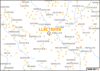
Llactovire (Arequipa, Peru)Llactovire is a town in the Arequipa region of Peru. An overview map of the region around Llactovire is displayed below.
regional and 3d topo map of Llactovire, Peru ::
Llactovire airports ::
The nearest airport is AQP - Arequipa Rodriguez Ballon, located 93.2 km south west of Llactovire.
Other airports nearby include JUL - Juliaca (109.0 km east), Nearby towns ::
Pacta (0.6km north east) //
Ccencco (1.5km south) //
Sayhua (2.2km west) //
Talcutaña (2.5km south east) //
Visalluyo (2.6km east) //
Canllutaña (2.7km south) //
Pucaccacca (2.8km south east) //
Huayllane (3.1km north west) //
Changarane (3.4km west) //
Ccaccahuasi (3.8km north west) //
Vuiscachane (3.9km south west) //
Patahua (4.2km north east) //
Andahua (4.9km west) //
Tagroma (5.0km south west) //
Mañascaycho (5.0km south east) //
Pasma (5.2km south) //
Pucacaca (5.2km south west) //
Mantarhuyo (5.4km north east) //
Mantarpujo (5.6km south) //
Sorapallca (5.5km west) //
Junimata (5.6km east) //
Viscachane (6.2km north east) //
Llapatira (6.3km north) //
Pampa Quiviri (6.5km south east) //
Quenco (7.0km north) //
Anccontaña (6.9km south east) //
Tuntana (6.9km north west) //
Cristóbal (7.1km south east) //
Pacotutuca (7.2km south west) //
[all distances 'as the bird flies' and approximate] 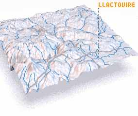 Places with similar names to Llactovire, Peru ::
// Lekhto-Vaara (RU)
// Lekhtovaara (RU)
// Llactaviri (PE)
// La Godefroy (FR)
// Lagoa de Fora (BR)
Disclaimer :: Information on this page comes without warranty of any kind |
||
|
Where is Llactovire? Elevation and coordinates ::
Latitude (lat): 15°36'8"S Longitude (lon): 71°9'52"W
Elevation (approx.): 4384m (map arrows pan, magnifying glasses zoom) |
||
|
Visiting Llactovire? Hotel/Accommodation ::
Book a hotel in Llactovire Travel Guide ::
Buy a travel guide for Peru rental cars ::
car rental offers GPS waypoint ::
download a GPX waypoint (PoI) of Llactovire for your GPS receiver
|
||