|
search place name
|
||
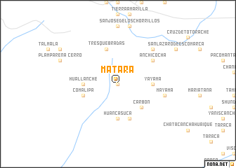
Matará (Lima, Peru)Matará is a town in the Lima region of Peru. An overview map of the region around Matará is displayed below.
regional and 3d topo map of Matará, Peru ::
Matará airports ::
The nearest airport is LIM - Lima Jorge Chavez Intl, located 76.0 km west of Matará.
Other airports nearby include PIO - Pisco Intl (169.1 km south), Nearby towns ::
Pared (0.0km north) //
Carbón (5.2km south east) //
Calahuaya (5.2km south east) //
Santo Domingo de los Olleros (5.4km west) //
Yayama (5.4km east) //
Huallanche (5.4km west) //
Huancasuca (5.6km south) //
Comalipa (5.7km west) //
Chatacancha (5.8km south) //
Tres Quebradas (5.8km north) //
Anchicocha (6.6km north east) //
Mayama (7.5km east) //
Anchicocha Bajo (7.8km north east) //
[all distances 'as the bird flies' and approximate]  Places with similar names to Matará, Peru ::
Disclaimer :: Information on this page comes without warranty of any kind |
||
|
Where is Matará? Elevation and coordinates ::
Latitude (lat): 12°14'0"S Longitude (lon): 76°27'0"W
Elevation (approx.): 2625m (map arrows pan, magnifying glasses zoom) |
||
|
Visiting Matará? Hotel/Accommodation ::
Book a hotel in Matará Travel Guide ::
Buy a travel guide for Peru rental cars ::
car rental offers GPS waypoint ::
download a GPX waypoint (PoI) of Matará for your GPS receiver
|
||