|
search place name
|
||
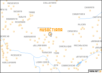
Musoctiana (Puno, Peru)Musoctiana is a town in the Puno region of Peru. An overview map of the region around Musoctiana is displayed below.
regional and 3d topo map of Musoctiana, Peru ::
Musoctiana airports ::
The nearest airport is JUL - Juliaca, located 126.7 km south of Musoctiana.
Other airports nearby include PEM - Puerto Maldonado Padre Aldamiz (204.7 km north), AQP - Arequipa Rodriguez Ballon (291.7 km south west), Nearby towns ::
Pajo Piña (1.7km west) //
Lahuane (1.8km north) //
Lahuaña (1.9km east) //
Jaño Jota (1.9km south east) //
Japo (2.1km south) //
Huayra Pata (2.4km west) //
Huarajo Pampa (2.5km south west) //
Altarani (2.7km south) //
Totora Cocha (2.9km north west) //
Ero Pata (3.4km south west) //
Collpacucho (4.2km south) //
Lichi Puquio (4.4km west) //
Challhuani (4.7km east) //
Chillitiana (5.3km south west) //
Llojarani Grande (5.6km south) //
Jollpa Pampa (5.9km south west) //
Pacchani (6.1km south west) //
Jatamaña (6.0km west) //
Fundición (7.1km south) //
Chaca Luque (7.2km south east) //
Quicuros (7.1km west) //
Tisña (7.5km south) //
Huari Umaña (7.4km west) //
Canu Canu (7.9km east) //
Chiaruya (8.6km south) //
Jatun Ojo (8.6km south east) //
Chajominas (8.9km south) //
Parquiotana (10.1km north west) //
Tambo (10.2km north west) //
[all distances 'as the bird flies' and approximate] 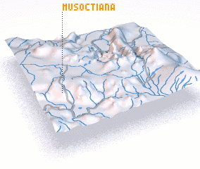 Places with similar names to Musoctiana, Peru :: Disclaimer :: Information on this page comes without warranty of any kind |
||
|
Where is Musoctiana? Elevation and coordinates ::
Latitude (lat): 14°23'27"S Longitude (lon): 69°45'20"W
Elevation (approx.): 4465m (map arrows pan, magnifying glasses zoom) |
||
|
Visiting Musoctiana? Hotel/Accommodation ::
Book a hotel in Musoctiana Travel Guide ::
Buy a travel guide for Peru rental cars ::
car rental offers GPS waypoint ::
download a GPX waypoint (PoI) of Musoctiana for your GPS receiver
|
||