|
search place name
|
||
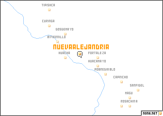
Nueva Alejandría (Loreto, Peru)Nueva Alejandría is a town in the Loreto region of Peru. An overview map of the region around Nueva Alejandría is displayed below.
regional and 3d topo map of Nueva Alejandría, Peru ::
Nueva Alejandría airports ::
The nearest airport is CZS - Cruiziro Do Sul Cruzeiro Do Sul, located 197.4 km south of Nueva Alejandría.
Nearby towns ::
Huacha (3.7km west) //
Fortaleza (3.7km east) //
Huacamayo (4.1km south east) //
Dos de Mayo (6.7km north west) //
Pobre Diablo (6.7km south east) //
Infiernillo (6.7km north west) //
Curinga (10.5km north west) //
[all distances 'as the bird flies' and approximate] 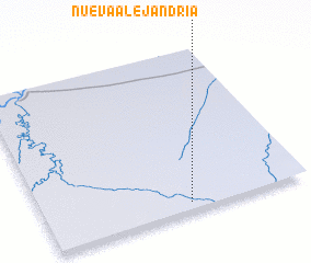 Places with similar names to Nueva Alejandría, Peru :: Disclaimer :: Information on this page comes without warranty of any kind |
||
|
Where is Nueva Alejandría? Elevation and coordinates ::
Latitude (lat): 5°57'0"S Longitude (lon): 73°27'0"W
Elevation (approx.): 173m (map arrows pan, magnifying glasses zoom) |
||
|
Visiting Nueva Alejandría? Hotel/Accommodation ::
Book a hotel in Nueva Alejandría Travel Guide ::
Buy a travel guide for Peru rental cars ::
car rental offers GPS waypoint ::
download a GPX waypoint (PoI) of Nueva Alejandría for your GPS receiver
|
||