|
search place name
|
||
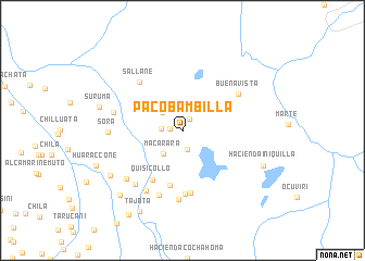
Pacobambilla (Cusco, Peru)Pacobambilla is a town in the Cusco region of Peru. An overview map of the region around Pacobambilla is displayed below.
regional and 3d topo map of Pacobambilla, Peru ::
Pacobambilla airports ::
The nearest airport is JUL - Juliaca, located 102.9 km south east of Pacobambilla.
Other airports nearby include AQP - Arequipa Rodriguez Ballon (155.4 km south west), CUZ - Cuzco Teniente Alejandro Velasco Astete Intl (194.9 km north west), Nearby towns ::
Tocollo (1.3km west) //
Janccachuani (1.4km north east) //
Sachane (2.0km south) //
Sora (2.1km west) //
Amayane (2.7km north west) //
Macarara (3.1km south west) //
Mayosura (4.0km north west) //
Chaqueylla (5.7km south) //
Quisicollo (5.9km south west) //
Patillane (6.4km south) //
Suruma (6.6km south) //
Sallane (6.5km north west) //
Buena Vista (6.7km north east) //
Quisimocco (7.0km south) //
Lego (7.1km south) //
Sutunta Bajo (7.1km south west) //
Pucara (7.1km west) //
Huayllane (7.3km south west) //
Hacienda Caicollane (7.4km south west) //
Sora (7.4km west) //
Hichocollo (8.6km south west) //
Suruma (8.6km west) //
Hacienda Iniquilla (8.9km south east) //
Hacienda Sapansaya (9.1km south west) //
Tajata (9.4km south west) //
Huaraccone (9.3km south west) //
Chectachancara (10.1km south west) //
[all distances 'as the bird flies' and approximate]  Places with similar names to Pacobambilla, Peru :: Disclaimer :: Information on this page comes without warranty of any kind |
||
|
Where is Pacobambilla? Elevation and coordinates ::
Latitude (lat): 15°2'57"S Longitude (lon): 71°0'50"W
Elevation (approx.): 4321m (map arrows pan, magnifying glasses zoom) |
||
|
Visiting Pacobambilla? Hotel/Accommodation ::
Book a hotel in Pacobambilla Travel Guide ::
Buy a travel guide for Peru rental cars ::
car rental offers GPS waypoint ::
download a GPX waypoint (PoI) of Pacobambilla for your GPS receiver
|
||