|
search place name
|
||
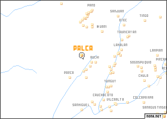
Palca (Lima, Peru)Palca is a town in the Lima region of Peru. An overview map of the region around Palca is displayed below.
regional and 3d topo map of Palca, Peru ::
Palca airports ::
The nearest airport is LIM - Lima Jorge Chavez Intl, located 86.9 km south of Palca.
Other airports nearby include ATA - Anta Comandante Fap German Arias Graziani (220.4 km north), Nearby towns ::
Quichin (2.0km east) //
Marin (2.1km south east) //
Huarangal (2.3km south) //
Campamento (2.6km south) //
Auchi (2.8km east) //
Chocapampa (4.1km south) //
Parca (5.1km south west) //
Quispihuay (5.9km east) //
Quinquera (6.4km east) //
Lanco (6.7km south east) //
Naupay (6.9km east) //
Quinquera (6.9km east) //
Sayan (7.0km east) //
Huaracnic (7.2km south east) //
Pichocancha (7.4km north) //
Ihuari (7.5km north east) //
Cullpa (7.6km north) //
Chohuitama (7.7km north) //
Maran Pampa (7.7km east) //
Matara (8.0km south east) //
Tan Tan (8.1km north) //
Cachoalin (8.0km east) //
Matarcan (8.2km east) //
Huamacho (8.3km south east) //
Huaycho (8.5km north) //
Yunguy (8.5km south east) //
Lamblan (8.7km east) //
Huaquilla (8.9km north) //
Ollancaca (9.1km south east) //
[all distances 'as the bird flies' and approximate] 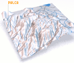 Places with similar names to Palca, Peru ::
Disclaimer :: Information on this page comes without warranty of any kind |
||
|
Where is Palca? Elevation and coordinates ::
Latitude (lat): 11°14'47"S Longitude (lon): 76°59'19"W
Elevation (approx.): 1718m (map arrows pan, magnifying glasses zoom) |
||
|
Visiting Palca? Hotel/Accommodation ::
Book a hotel in Palca Travel Guide ::
Buy a travel guide for Peru rental cars ::
car rental offers GPS waypoint ::
download a GPX waypoint (PoI) of Palca for your GPS receiver
|
||