|
search place name
|
||
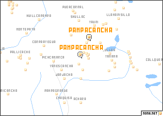
Pampacancha (Lima, Peru)Pampacancha is a town in the Lima region of Peru. An overview map of the region around Pampacancha is displayed below.
regional and 3d topo map of Pampacancha, Peru ::
Pampacancha airports ::
The nearest airport is LIM - Lima Jorge Chavez Intl, located 98.1 km west of Pampacancha.
Other airports nearby include PIO - Pisco Intl (195.8 km south), Nearby towns ::
Patacancha (1.2km north) //
Ueo (1.4km north east) //
Mataga (1.5km south west) //
Tucupayen (1.6km north east) //
Ayarhuayque (1.6km east) //
Tucincocha (1.8km north east) //
Aguacancha (2.8km south) //
Pilcocancha (3.3km north east) //
Patacancha (3.7km north) //
Pampacancha (4.5km north east) //
Huicllo (4.5km north) //
Chujupata (4.7km south) //
Yanescancha (5.2km south west) //
Huarmune (5.5km north east) //
Huarascancha (5.8km north west) //
Jarjacha (6.0km south west) //
Pichcamarca (6.2km west) //
Jullga (6.4km east) //
Tambo (6.7km south east) //
Yanama (6.8km east) //
Panteón (7.0km north east) //
Tonto (7.3km north east) //
Atunga (7.6km east) //
Huajracancha (7.8km east) //
Yauri (8.0km north) //
Shullac (8.7km north) //
Corpaayegua (8.8km west) //
Ropacoto (9.2km north east) //
Carhuacayanga (9.3km north east) //
[all distances 'as the bird flies' and approximate] 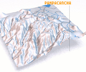 Places with similar names to Pampacancha, Peru ::
// Pampa Cancha (PE)
// Pampa Cancha (PE)
// Pampacancha (PE)
// Pampacancha (PE)
// Pampacancha (PE)
Disclaimer :: Information on this page comes without warranty of any kind |
||
|
Where is Pampacancha? Elevation and coordinates ::
Latitude (lat): 11°58'29"S Longitude (lon): 76°12'53"W
Elevation (approx.): 4157m (map arrows pan, magnifying glasses zoom) |
||
|
Visiting Pampacancha? Hotel/Accommodation ::
Book a hotel in Pampacancha Travel Guide ::
Buy a travel guide for Peru rental cars ::
car rental offers GPS waypoint ::
download a GPX waypoint (PoI) of Pampacancha for your GPS receiver
|
||