|
search place name
|
||
Papaya Alta (Amazonas, Peru)Papaya Alta is a town in the Amazonas region of Peru. An overview map of the region around Papaya Alta is displayed below.
regional and 3d topo map of Papaya Alta, Peru ::

Papaya Alta airports ::
The nearest airport is CHH - Chachapoyas, located 104.8 km south east of Papaya Alta.
Other airports nearby include CIX - Chiclayo Capt Jose A Quinones Gonzales Intl (189.2 km south west), JJI - Juanjui (269.1 km south east), Nearby towns ::
El Triunfo (0.7km north) //
Aviación (0.9km south west) //
Zapote (2.1km south west) //
Papaya Medio (2.8km north east) //
San Pedro (2.8km north east) //
El Mango (3.0km north west) //
Tambillo (3.8km west) //
Sambimera (4.1km west) //
Papaya Baja (4.2km north) //
Niño Pobre (4.4km north east) //
Milagro (4.7km south east) //
Huaranguillo (4.8km south east) //
Campamento de Ingeniería Marañón (4.9km south east) //
La Cerma (5.0km west) //
Casual (5.0km north east) //
Flor de La Esperanza (5.0km east) //
La Cabra (5.7km east) //
Limón Yacu Bajo (6.0km north east) //
Las Juntas (6.0km south east) //
Bagua (7.5km south east) //
San Luis (8.8km south west) //
Aserillo (9.2km north east) //
Brujo Pata (9.4km east) //
Bodoque (10.2km south east) //
Pueblo Nuevo (11.0km south east) //
Puche (11.2km north east) //
Esperanza (12.4km south east) //
[all distances 'as the bird flies' and approximate] 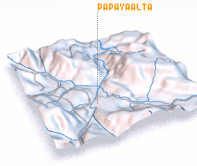 Places with similar names to Papaya Alta, Peru :: Disclaimer :: Information on this page comes without warranty of any kind |
||
|
Where is Papaya Alta? Elevation and coordinates ::
Latitude (lat): 5°36'20"S Longitude (lon): 78°35'31"W
Elevation (approx.): 423m (map arrows pan, magnifying glasses zoom) |
||
|
Visiting Papaya Alta? Hotel/Accommodation ::
Book a hotel in Papaya Alta Travel Guide ::
Buy a travel guide for Peru rental cars ::
car rental offers GPS waypoint ::
download a GPX waypoint (PoI) of Papaya Alta for your GPS receiver
|
||