|
search place name
|
||
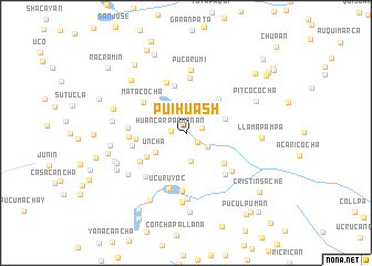
Puihuash (Junín, Peru)Puihuash is a town in the Junín region of Peru. An overview map of the region around Puihuash is displayed below.
regional and 3d topo map of Puihuash, Peru ::
Puihuash airports ::
The nearest airport is LIM - Lima Jorge Chavez Intl, located 167.9 km south west of Puihuash.
Other airports nearby include ATA - Anta Comandante Fap German Arias Graziani (273.4 km north west), Nearby towns ::
Huancar Pashanan (1.5km west) //
Chapa Ishgé (1.5km south east) //
Chiquiacancha (1.6km east) //
Laclan (1.9km north) //
Cashapucro (2.6km south east) //
Capillayoc (2.9km south) //
Uncha (3.6km south west) //
Curicocha (4.1km east) //
Huachuarccan (4.6km south west) //
Ccaramachay (4.7km north east) //
Cashamachay (4.9km north) //
Pucllocancha (4.9km south east) //
Chicyacuy (5.0km west) //
Matacocha (5.2km north west) //
Verde Machay (5.4km north) //
Uncha (5.4km south west) //
Shalacancha (5.5km north) //
Garbanzo Cancha (5.5km west) //
Huanto Cancha (5.6km west) //
Rocoscocha (5.7km south east) //
Suitucancha (5.9km south) //
Huaro Cancha (5.8km west) //
Ucuruyoc (5.9km south) //
Atojhuain (5.9km south west) //
Patacancha (6.0km south east) //
Pucarumi (6.4km north) //
Contaderacancha (6.7km south) //
Paucarcoto (7.0km south) //
Quiacancha (7.1km south west) //
[all distances 'as the bird flies' and approximate]  Places with similar names to Puihuash, Peru :: Disclaimer :: Information on this page comes without warranty of any kind |
||
|
Where is Puihuash? Elevation and coordinates ::
Latitude (lat): 11°7'45"S Longitude (lon): 75°52'9"W
Elevation (approx.): 4432m (map arrows pan, magnifying glasses zoom) |
||
|
Visiting Puihuash? Hotel/Accommodation ::
Book a hotel in Puihuash Travel Guide ::
Buy a travel guide for Peru rental cars ::
car rental offers GPS waypoint ::
download a GPX waypoint (PoI) of Puihuash for your GPS receiver
|
||