|
search place name
|
||
Ruruy (Lima, Peru)Ruruy is a town in the Lima region of Peru. An overview map of the region around Ruruy is displayed below.
regional and 3d topo map of Ruruy, Peru ::

Ruruy airports ::
The nearest airport is LIM - Lima Jorge Chavez Intl, located 103.3 km south west of Ruruy.
Other airports nearby include ATA - Anta Comandante Fap German Arias Graziani (226.6 km north west), Nearby towns ::
Ccarapampa (0.6km south east) //
Huactacancha (1.6km north east) //
Acobamba (1.7km north east) //
Viscas (2.5km south east) //
Gumo (2.5km north west) //
Rupay Cancha (3.4km west) //
Azulcocha (3.6km west) //
Ravira (3.8km south east) //
Cocar Huasin (3.9km north) //
Pacaraos (4.5km east) //
Ayshacancha (4.9km north) //
Fundo Mayo (4.9km south east) //
Chauca (4.9km east) //
Huacracayan (5.0km west) //
Tingo (5.1km south east) //
Santa Catalina (5.7km east) //
Collpor (5.9km south) //
Rapacan (5.9km south) //
Tambillo (5.9km south) //
Huahuichurco (5.9km north) //
Santa Cruz de Andamarca (5.9km east) //
Jacra (6.1km north west) //
Rancatama (6.3km south) //
Pirca (6.3km south east) //
Ayshacancha (6.7km north) //
Chunca (6.8km south west) //
Litma (6.9km north west) //
San Jose (7.2km south) //
Pasac (7.2km south) //
[all distances 'as the bird flies' and approximate] 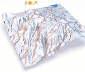 Places with similar names to Ruruy, Peru ::
Disclaimer :: Information on this page comes without warranty of any kind |
||
|
Where is Ruruy? Elevation and coordinates ::
Latitude (lat): 11°11'16"S Longitude (lon): 76°41'19"W
Elevation (approx.): 4350m (map arrows pan, magnifying glasses zoom) |
||
|
Visiting Ruruy? Hotel/Accommodation ::
Book a hotel in Ruruy Travel Guide ::
Buy a travel guide for Peru rental cars ::
car rental offers GPS waypoint ::
download a GPX waypoint (PoI) of Ruruy for your GPS receiver
|
||