|
search place name
|
||
San Bartolomé (Lima, Peru)San Bartolomé is a town in the Lima region of Peru. An overview map of the region around San Bartolomé is displayed below.
regional and 3d topo map of San Bartolomé, Peru ::

San Bartolomé airports ::
The nearest airport is LIM - Lima Jorge Chavez Intl, located 65.2 km west of San Bartolomé.
Other airports nearby include PIO - Pisco Intl (205.4 km south), Nearby towns ::
Cocachacra (1.3km west) //
Verrugas (3.4km north) //
Lucumani (4.7km south east) //
La Palma (4.8km south west) //
San Juan de Lanca (4.9km north west) //
Huancro (5.1km south east) //
Malcanchi (6.9km south east) //
Llamcha (7.1km south east) //
Perqueshica (7.1km south east) //
Chinchina (7.1km south east) //
Otao (7.5km north) //
Llanahuanchi (7.5km south east) //
Arenel (7.7km north east) //
Santiago de Tuna (7.9km south) //
Linday (8.1km north east) //
Queñihua (8.2km south east) //
La Toma (8.2km east) //
Tushan (8.5km east) //
Miraflores (8.6km north east) //
Lucomana (8.6km north east) //
Pucchand (8.5km east) //
Chapo (8.7km east) //
Miramar (9.3km north east) //
[all distances 'as the bird flies' and approximate] 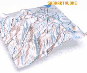 Places with similar names to San Bartolomé, Peru ::
// San Bartolomeo (IT)
// San Bartolomeo (IT)
// San Bartolomeo (IT)
// San Bartolomeo (IT)
// San Bartolomeo (IT)
// San Bartolomeo (IT)
// San Bartolomeo (IT)
// San Bartolomeo (IT)
// San Bartolomeo (IT)
// San Bartolomeo (IT)
Disclaimer :: Information on this page comes without warranty of any kind |
||
|
Where is San Bartolomé? Elevation and coordinates ::
Latitude (lat): 11°54'47"S Longitude (lon): 76°31'35"W
Elevation (approx.): 1620m (map arrows pan, magnifying glasses zoom) |
||
|
Visiting San Bartolomé? Hotel/Accommodation ::
Book a hotel in San Bartolomé Travel Guide ::
Buy a travel guide for Peru rental cars ::
car rental offers GPS waypoint ::
download a GPX waypoint (PoI) of San Bartolomé for your GPS receiver
|
||