|
search place name
|
||
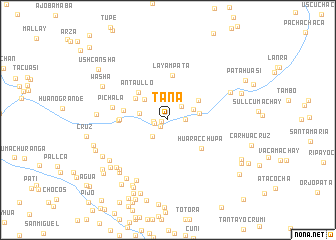
Tana (Lima, Peru)Tana is a town in the Lima region of Peru. An overview map of the region around Tana is displayed below.
regional and 3d topo map of Tana, Peru ::
Tana airports ::
The nearest airport is PIO - Pisco Intl, located 112.9 km south west of Tana.
Other airports nearby include AYP - Ayacucho Coronel Fap Alfredo Mendivil Duarte (171.5 km east), LIM - Lima Jorge Chavez Intl (173.3 km north west), Nearby towns ::
Omas (0.8km west) //
Cochamarca (1.0km south west) //
Cutimullo (1.5km west) //
Anta (1.6km west) //
Huananta (1.9km east) //
Buenos Aires (2.0km north east) //
Urca (2.5km south west) //
Jochamarca (2.5km south west) //
Huananta (3.0km north east) //
Hongos (3.1km north west) //
Aquinhua (3.1km west) //
Huatara (3.4km north west) //
Canchapata (3.5km east) //
Ayahuasi (4.0km north east) //
Cacra (4.3km north west) //
Antaullo (4.4km north west) //
Huaracchupa (4.9km south east) //
Layampata (5.0km north) //
Huanchuy (5.0km west) //
Ulcuto (5.3km west) //
Villa Franca (5.3km west) //
San José (5.4km west) //
Pichala (6.2km west) //
Chacamarca (7.5km north east) //
Ayarumi (7.6km south west) //
Tororumi (7.6km south west) //
Huaychauhuancana (7.7km south west) //
Picunsa (7.7km south west) //
Grau (7.9km south west) //
[all distances 'as the bird flies' and approximate] 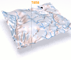 Places with similar names to Tana, Peru ::
Disclaimer :: Information on this page comes without warranty of any kind |
||
|
Where is Tana? Elevation and coordinates ::
Latitude (lat): 12°50'2"S Longitude (lon): 75°45'4"W
Elevation (approx.): 2535m (map arrows pan, magnifying glasses zoom) |
||
|
Visiting Tana? Hotel/Accommodation ::
Book a hotel in Tana Travel Guide ::
Buy a travel guide for Peru rental cars ::
car rental offers GPS waypoint ::
download a GPX waypoint (PoI) of Tana for your GPS receiver
|
||