|
search place name
|
||
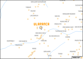
Ularanca (Lima, Peru)Ularanca is a town in the Lima region of Peru. An overview map of the region around Ularanca is displayed below.
regional and 3d topo map of Ularanca, Peru ::
Ularanca airports ::
The nearest airport is LIM - Lima Jorge Chavez Intl, located 108.1 km south of Ularanca.
Other airports nearby include ATA - Anta Comandante Fap German Arias Graziani (202.5 km north), CHM - Chimbote Teniente Jaime A De Montreuil Morales (273.2 km north west), Nearby towns ::
Santa Cruz (1.3km east) //
Tayapampa (2.0km west) //
Santo Domingo de Apache (2.2km north west) //
Chiguil (2.5km south) //
Machachaca (2.7km south) //
Dos de Mayo (3.2km south) //
Auquimarca (3.2km east) //
Jacanmachay (3.7km south) //
Chipcho (3.9km south) //
Ancascocha (4.2km south) //
Jatun Mito (4.3km south) //
Mane (4.4km south west) //
Maricocha (4.5km south) //
Lacsanga (6.0km north west) //
Yancao (6.3km south) //
Acopara (6.4km south west) //
Chaura (6.4km south) //
Iscaicancha (7.2km south east) //
Raucuta (7.7km east) //
Collaray (7.7km north west) //
Huailapampa (8.0km south) //
Muzga (8.1km north west) //
Sacro (8.7km north east) //
Tunsucancha (8.9km east) //
Cochuara (10.3km south west) //
Yaquin (10.5km north west) //
[all distances 'as the bird flies' and approximate]  Places with similar names to Ularanca, Peru :: Disclaimer :: Information on this page comes without warranty of any kind |
||
|
Where is Ularanca? Elevation and coordinates ::
Latitude (lat): 11°3'33"S Longitude (lon): 76°56'33"W
Elevation (approx.): 3412m (map arrows pan, magnifying glasses zoom) |
||
|
Visiting Ularanca? Hotel/Accommodation ::
Book a hotel in Ularanca Travel Guide ::
Buy a travel guide for Peru rental cars ::
car rental offers GPS waypoint ::
download a GPX waypoint (PoI) of Ularanca for your GPS receiver
|
||